The sun peeks above the mountain ridge to the east of Chama, New Mexico.
From our window at Foster’s Hotel and Bar, we can see a small trail of smoke rising from a small railyard. A crew is getting a steam engine ready to pull today’s eastbound Cumbres and Toltec Scenic Railroad train up and over Cumbres Pass and the San Juan Mountains to Antonito, Colorado. And we’re going to be riding it.
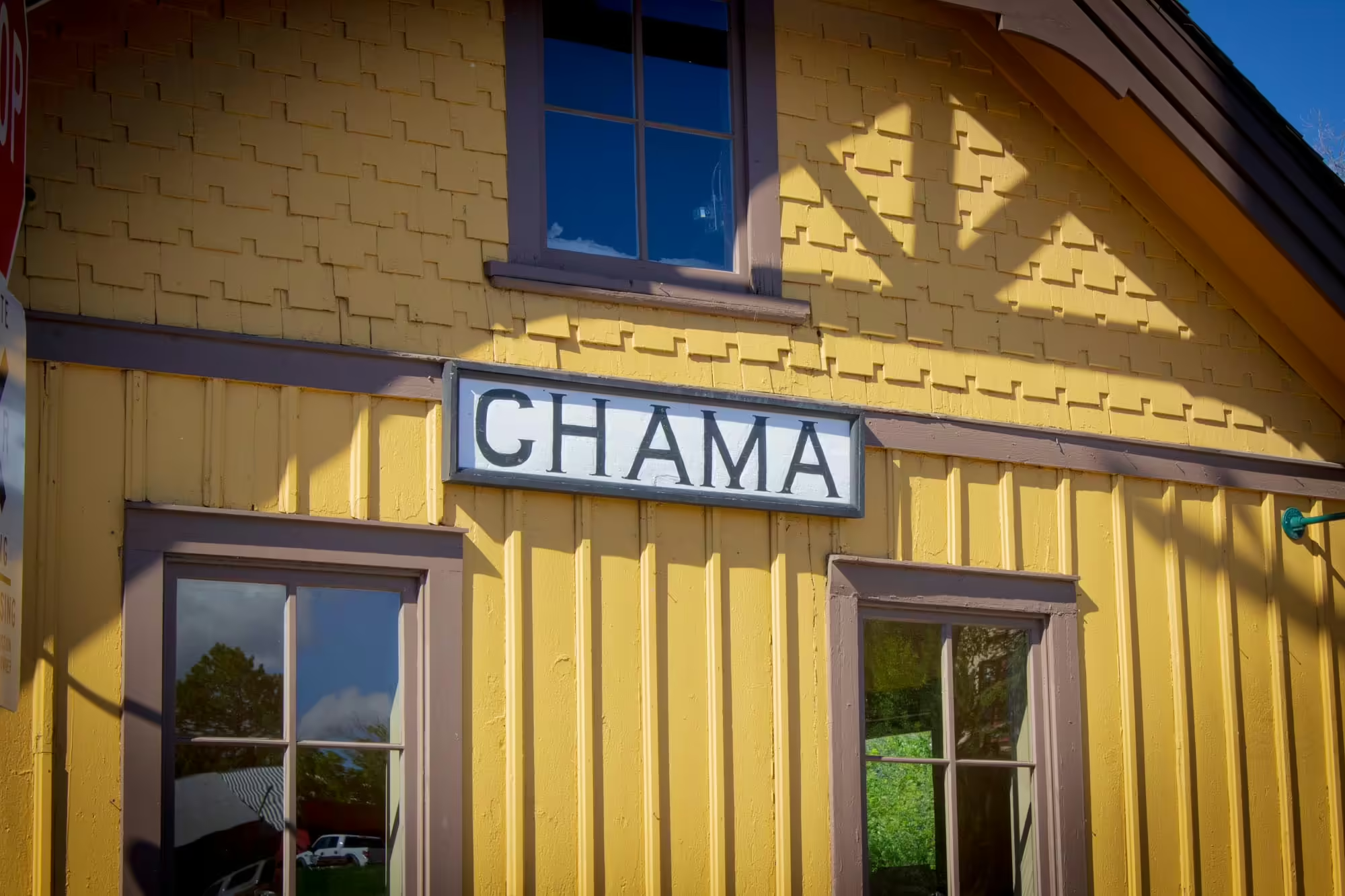
After grabbing a quick bite for breakfast and getting ready for the journey ahead, we grab our tickets and cross over State Highway 17 to the station.
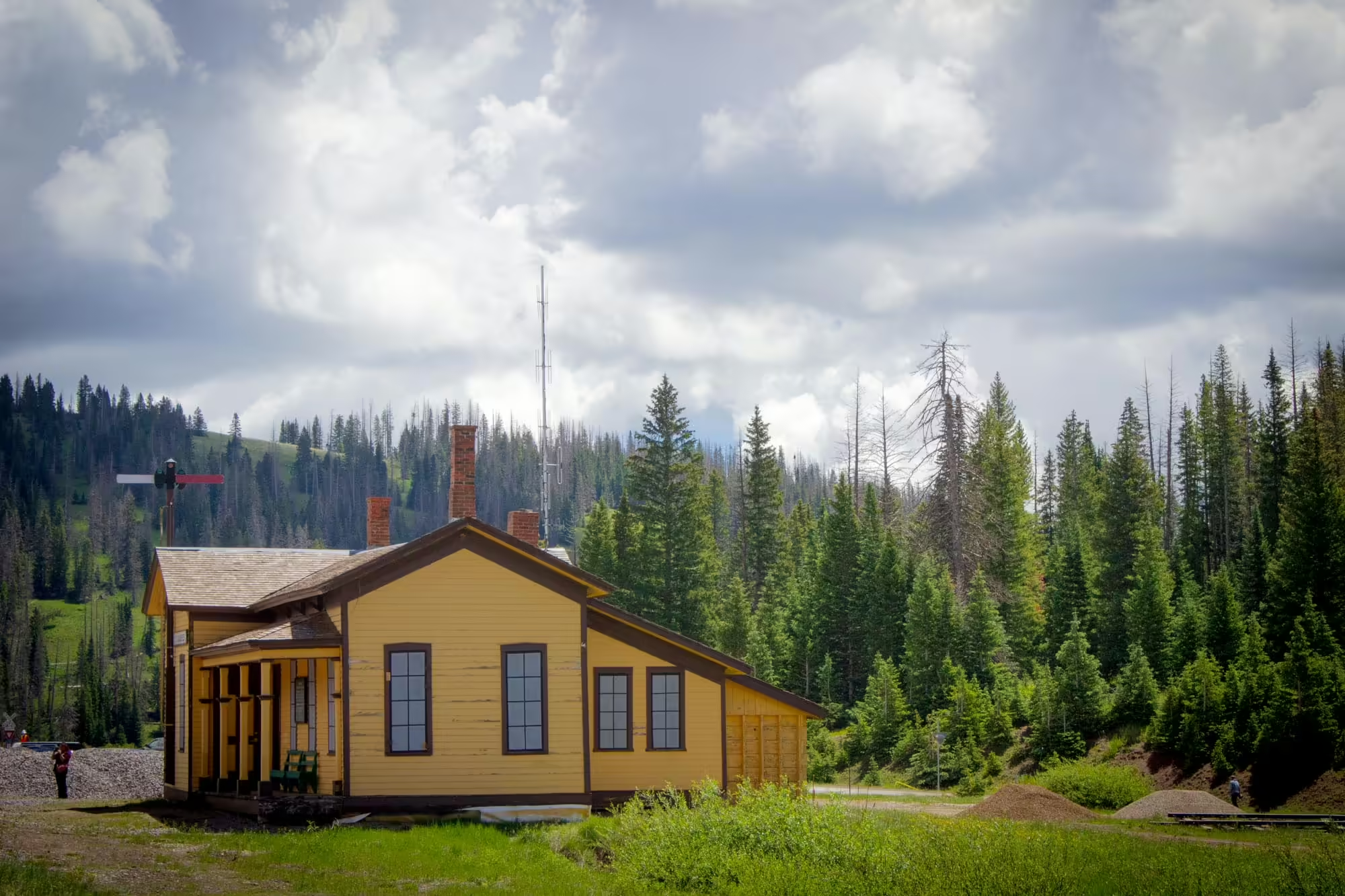
The yellow colored building was built back in 1881 when the Denver and Rio Grande Western’s San Juan Extension, a narrow gauge line, reached the town on its way to Durango, Colorado.
Inside, people wait to try to purchase last-minute tickets to ride the train while others with tickets in hand sit in the waiting room waiting to board.
Heading back out and down the side, we come to the gift shop. Inside this small room are shelves filled with railroad memorabilia, books about the railroad and the San Juan Mountains, pins, kids toys, stickers, model trains and more.
But we’re not here for any of that today.
Instead, our interest lies with the steam train we saw when we woke up. So we start to walk north towards the head end of the train and the steam engine.
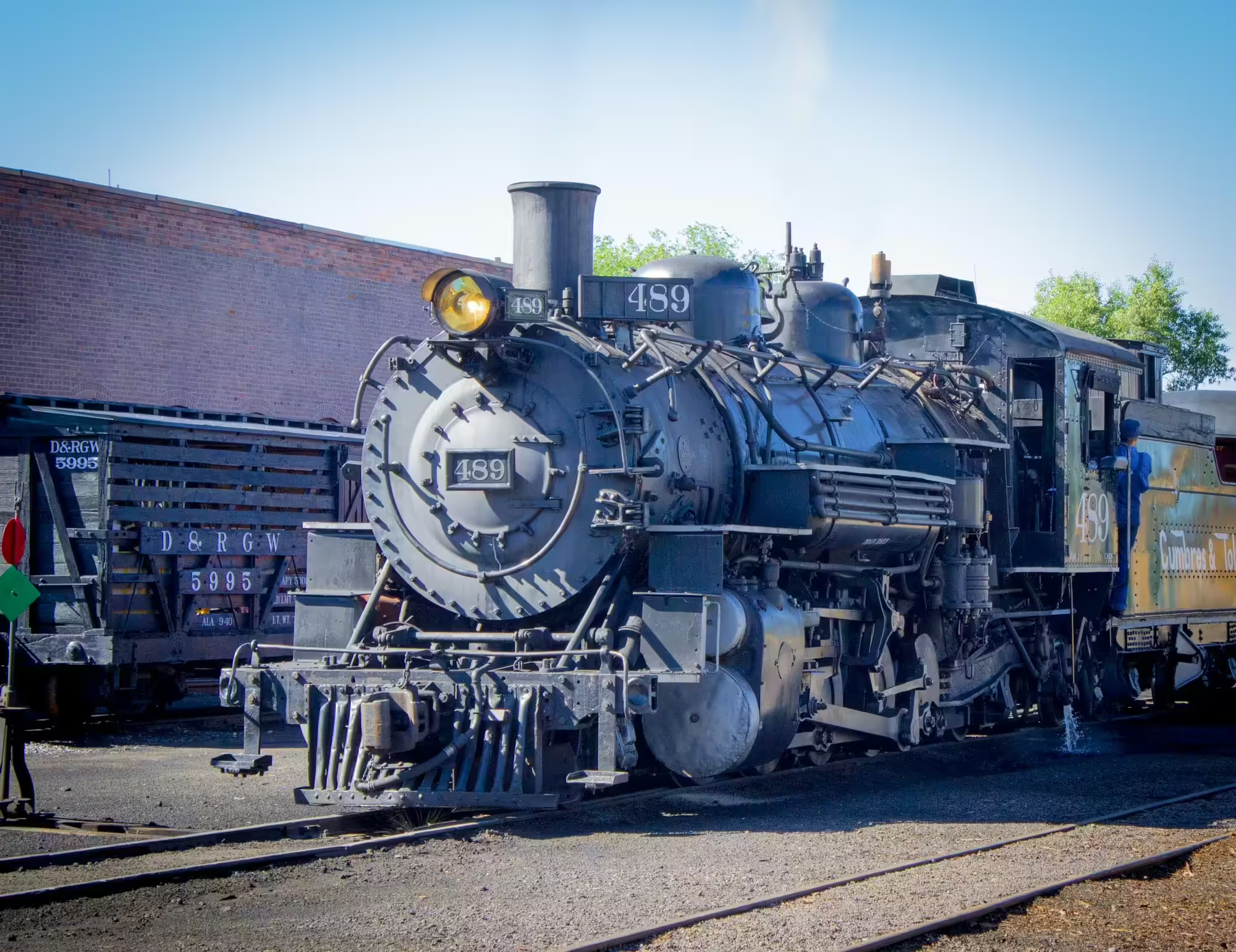
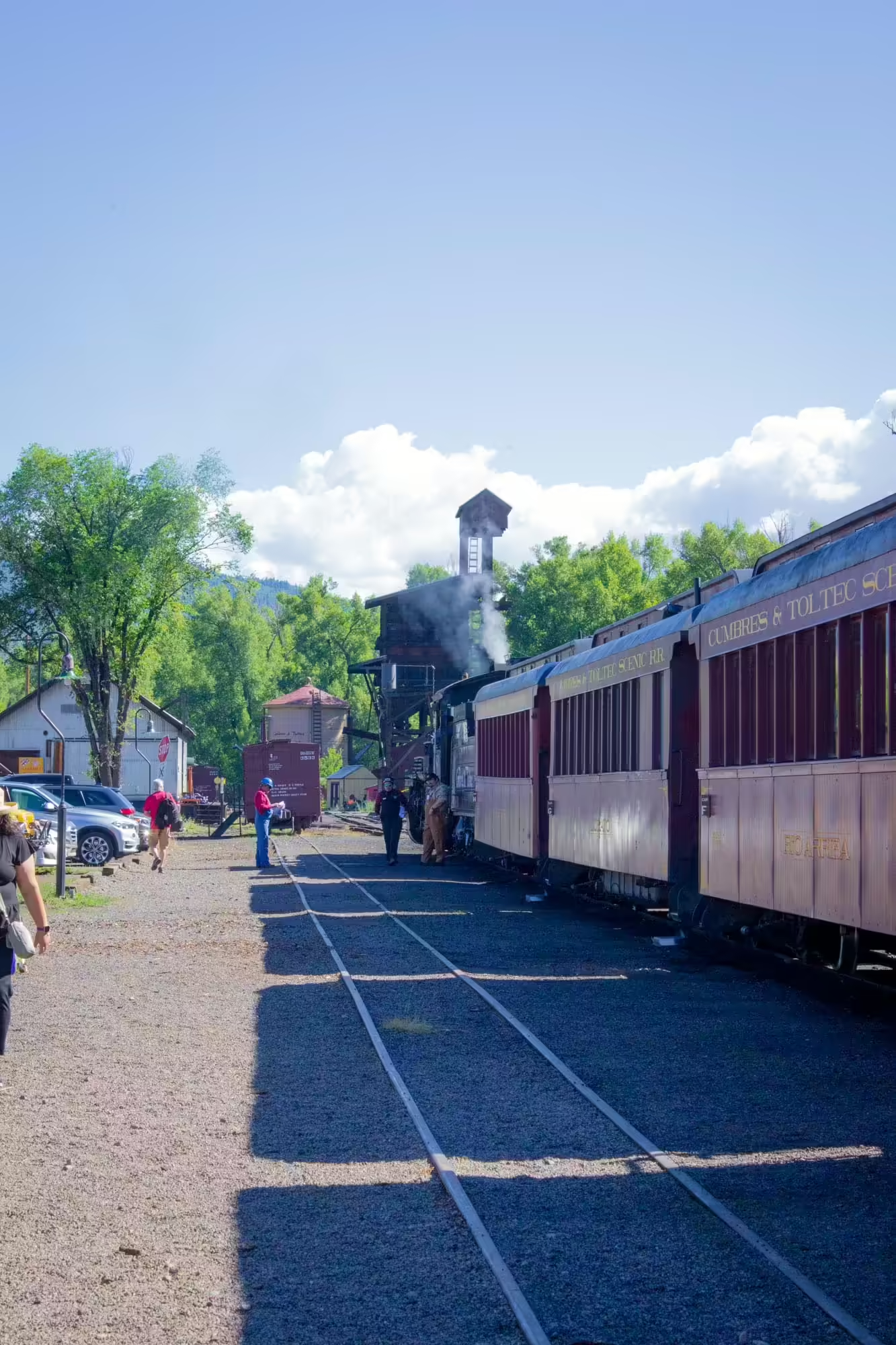
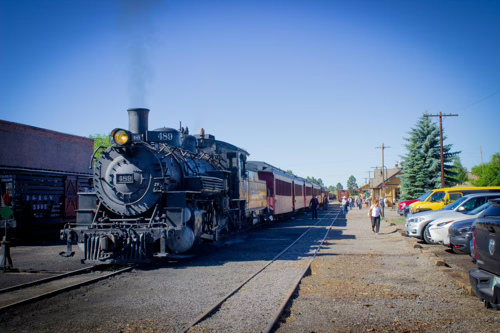
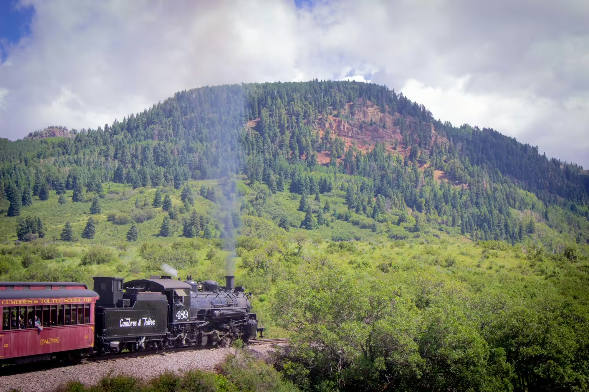
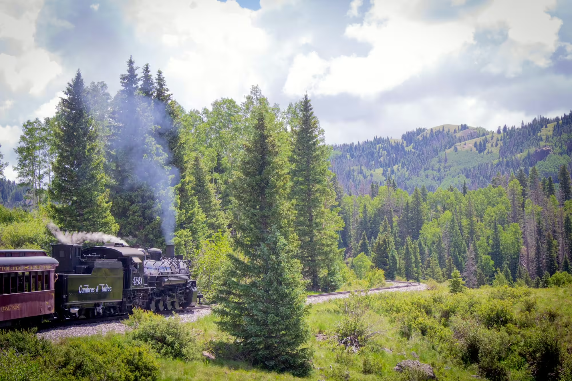
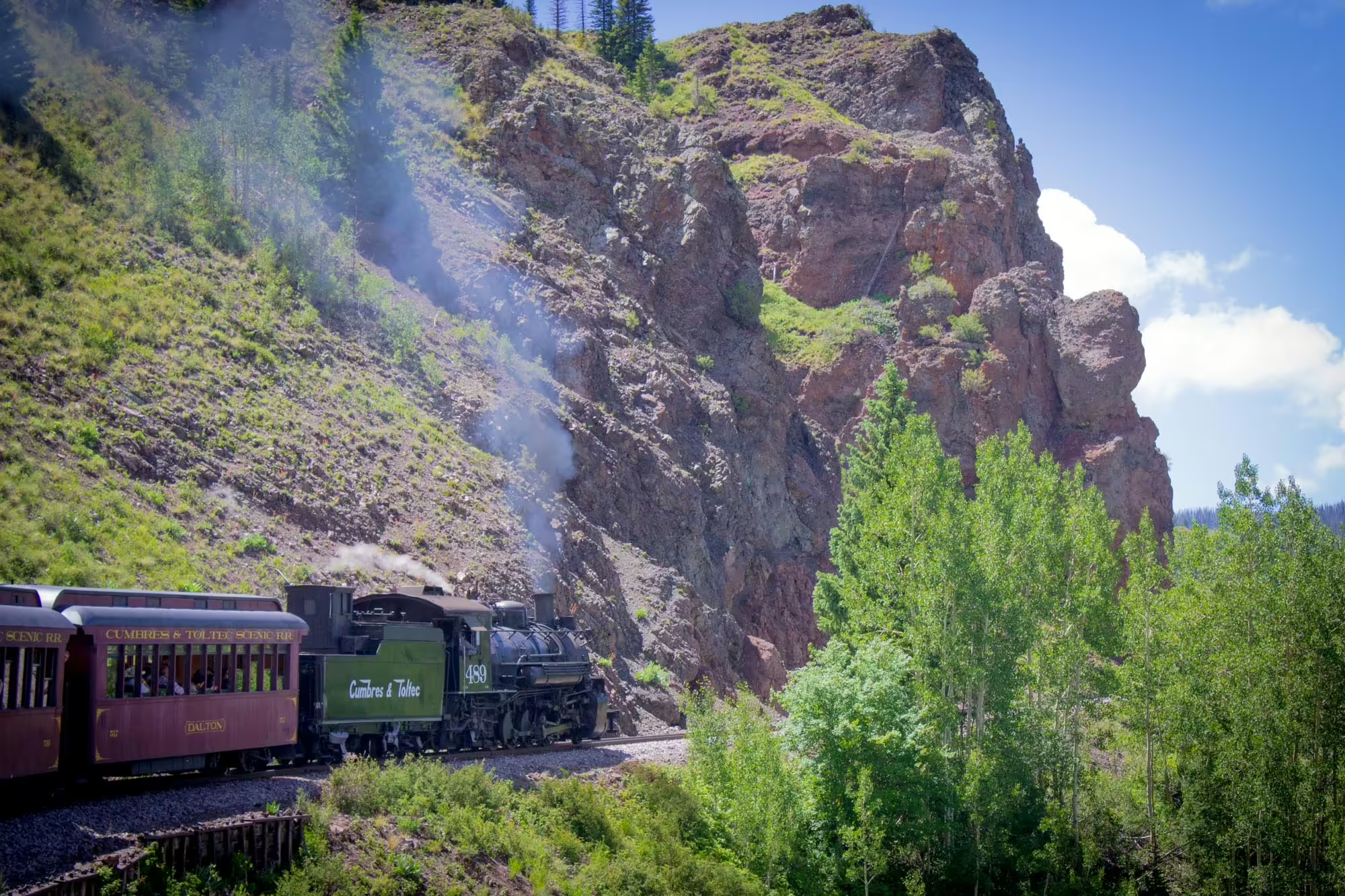
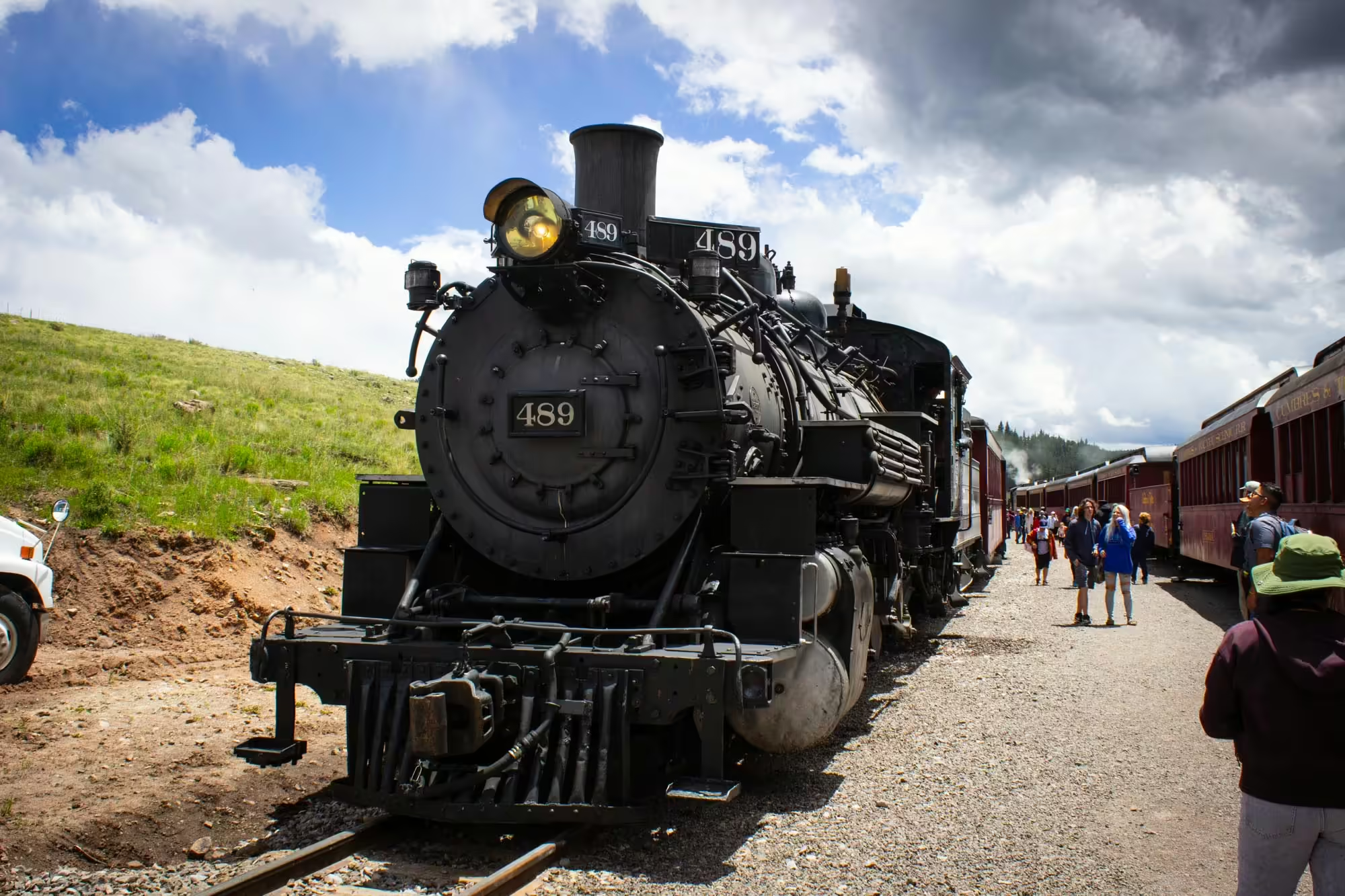
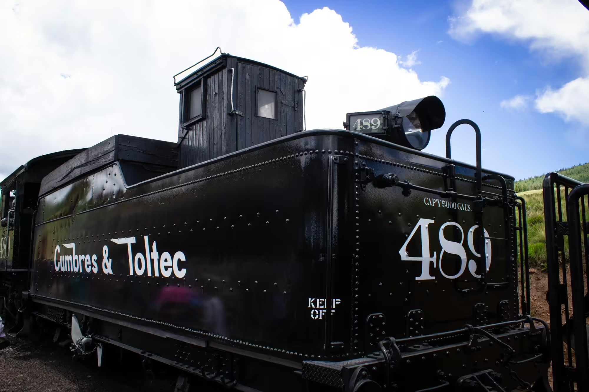
This is Cumbres and Toltec No. 489, a 2-8-2 K-36 class “Mikado” steam engine. Built in 1929 by the Baldwin Locomotive Works in Philadelphia, No. 489 spent the majority of her early life working on the Denver and Rio Grande Western’s extensive narrow gauge network of lines in the Colorado mountains.
Today, No. 489 is the main steam engine on the western side of the Cumbres and Toltec Scenic Railroad. She’ll pull our train up and over Cumbres Pass before swapping with the westbound train at Osier, Colorado, and returning to Chama with that train.
As her crew continues to check the engine for any issues and prepares her for today’s journey, we take pictures and look around the railyard.
Chama used to be an important part of the San Juan Extension for the D&RGW, housing an engine terminal where steam engines would be serviced and extra engines provided for trains making the eastbound journey from Durango up across Cumbres Pass to Antonito and points eastward.
Today, much of the tracks and buildings of the yard remain, thanks to the Cumbres and Toltec Scenic Railroad, which took over the line between Chama and Antonito after the D&RGW filed to abandon the line in 1968. Since taking over the line, the C&TS has operated daily east and westbound trains for tourists to ride to get an amazing view of what the San Juan Mountains have to offer.
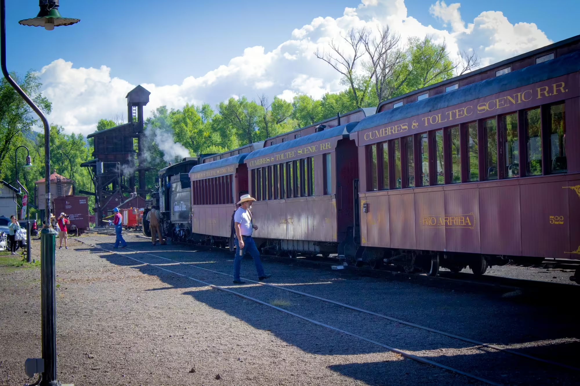
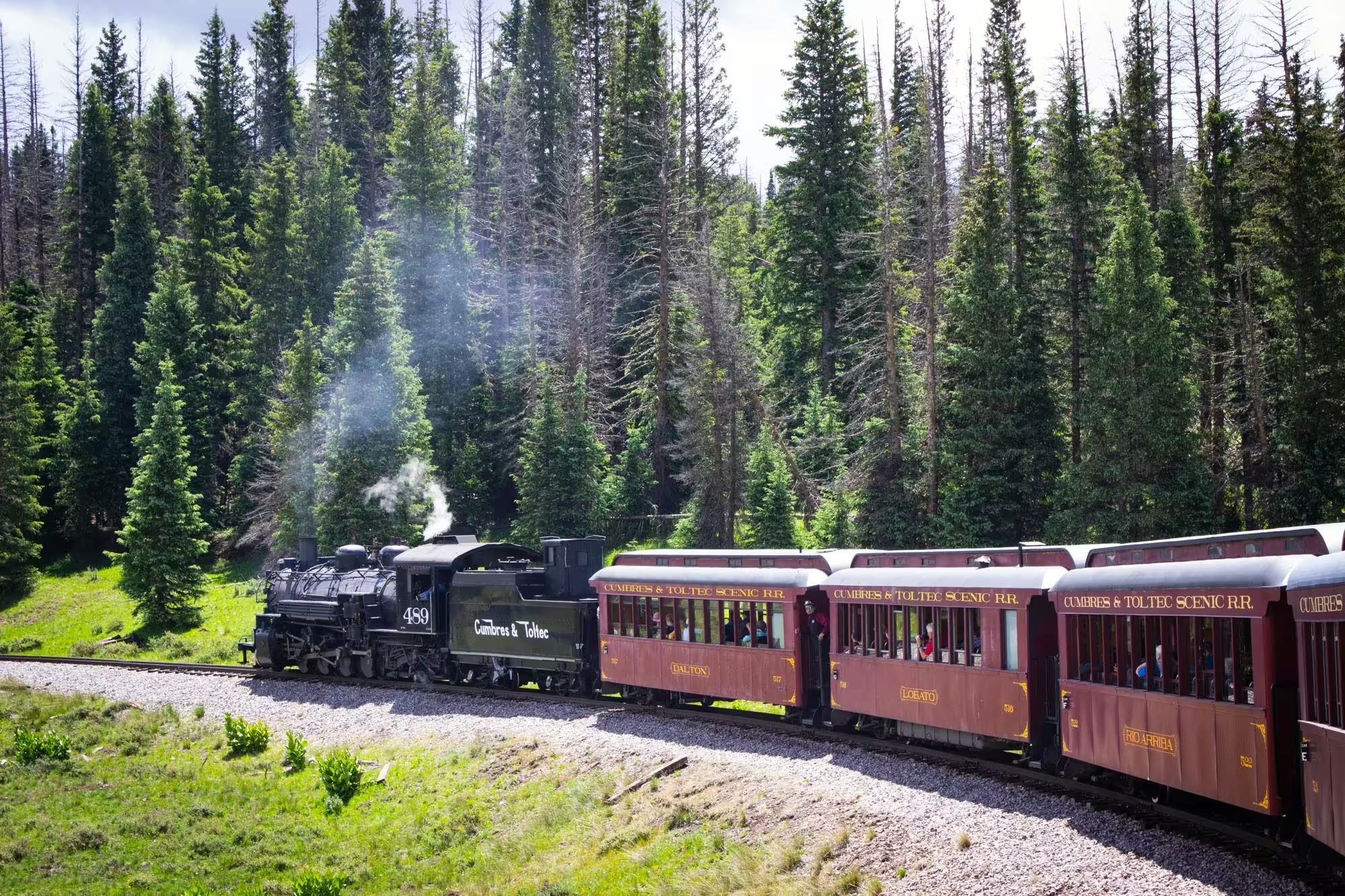
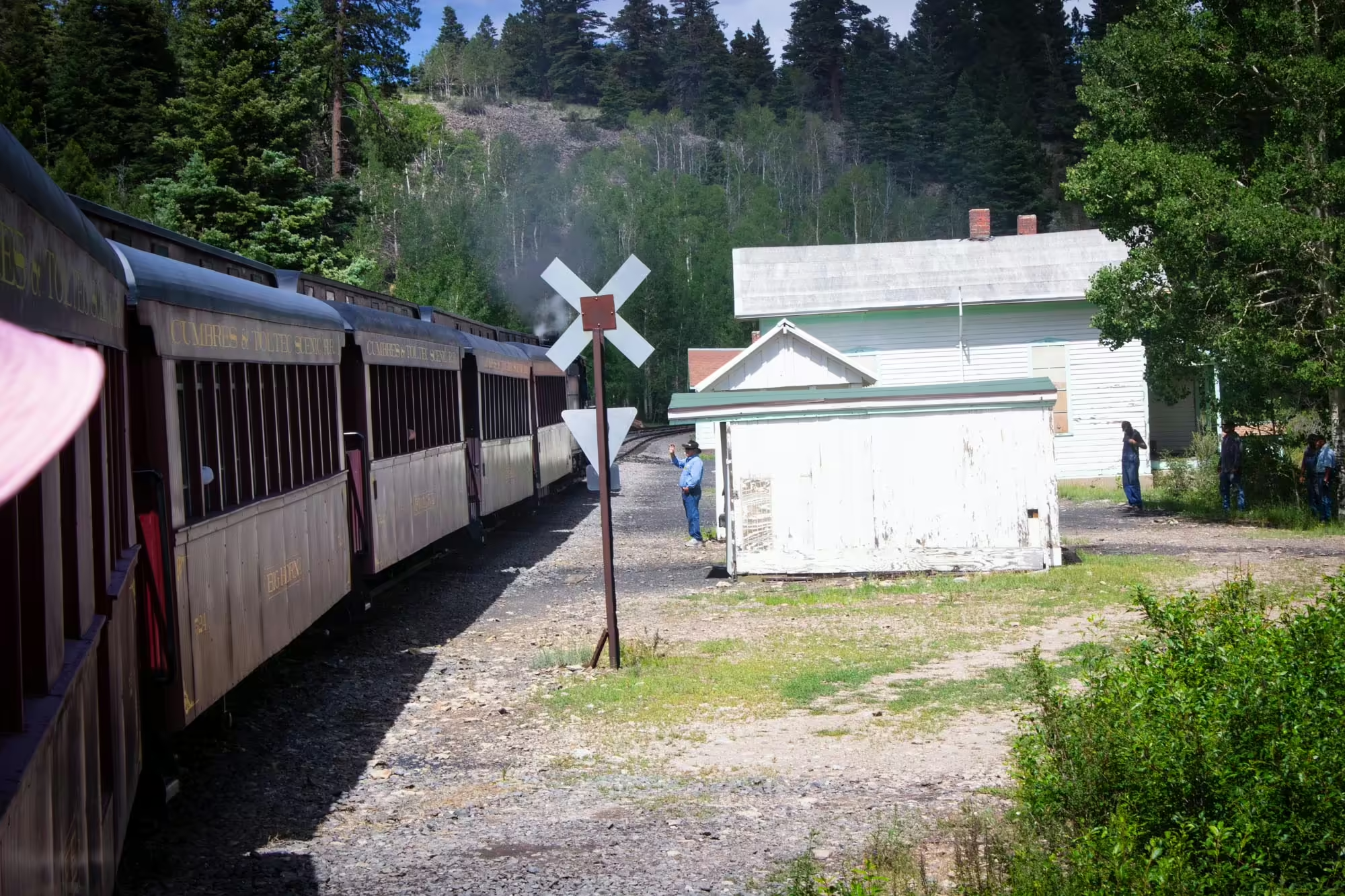
A blast of No. 489’s whistle reminds us that we need to actually board this train, and we make our way to the third car on the train. As we approach our car, a charter bus pulls up with people from Antonito who will be taking our train back across the pass to where they started the day.
Our train today features eight cars. The first three are refurbished coach cars from the D&RGW days painted in a faded red. Another faded red car is the cafe car followed by a gondola car that’s been refurbished to allow people to stand in it and get a 360 degree view of the journey. Finally, there are two more red premium coach cars followed by a faded red caboose.
We show our tickets to the car attendant waiting to help us up onto the car and take our seats. Moments later, the engine gives two blasts from No. 489’s whistle and the train lurches forward.
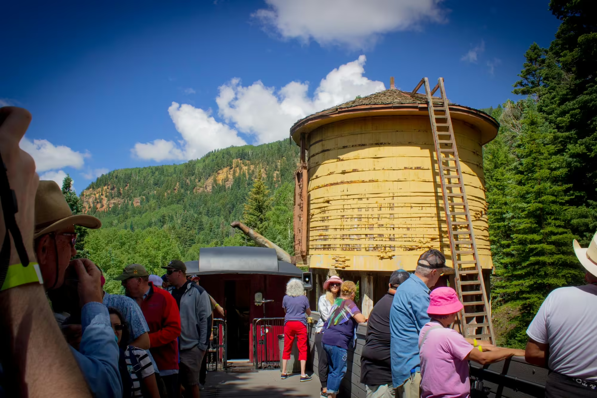
We pass the red brick engine house, the old wooden coaling tower, a yellow water tank for the steam engines, some refurbished old D&RGW rolling stock and begin to leave the town of Chama behind.
As we cross the Rio Chama over a gray steel-truss bridge, No. 489 starts the climb up the four percent grade towards Cumbres Pass, a climb of nearly 3,000 feet.
The reason this line exists is because of the vast silver and gold mines over 80 miles to the northwest around Silverton, Colorado.
Mining in Colorado got its start when brigadier general Zebulon Pike wrote in his journal that someone named James Pursley showed him a gold nugget from near present day Leadville, Colorado, in 1807.
But it would be another 40 years before more rumors about gold in the Rocky Mountains would circulate again. In 1850, James W. Marshal found gold on his party’s travels to the California Gold Rush. And in 1857, William Green Russell and his party found gold near present-day Denver, kicking off the Pikes Peak Gold Rush.
Beginning in 1858, the gold rush would see over 100,000 prospectors flock to the territory. Not everyone that hit the road west across the plains to the Rocky Mountains would strike it rich. But they would help the Colorado Territory become the 38th state in the United States in 1876.
As for the history of mining in the San Juan Mountains, which would eventually lead to the creation of this line, it started in 1860 with Charles Baker discovering gold in the area.
But it would not see the same explosion of prospectors and mines that the Pikes Peak area saw until an 1873 treaty with the Ute tribe in the area opened up the San Juans to settlement.
More and more people flocked to the area in the hopes of striking it rich, and more mines began to open up around the Silverton area.
Now it was a race to find the best way to get the gold and silver out of the mountains and onto the market.
Leaving the town of Chama, we begin our journey at an elevation of 7,863 feet. But in order to get over the San Juan Mountains, we have to reach an elevation of 10,015 feet at Cumbres Pass, 13 miles away.
That means a lot of our early part of the journey will be spent climbing a four percent grade (meaning for every 100 feet of track we are gaining four feet of elevation). It’s among the steepest narrow gauge lines in the United States.
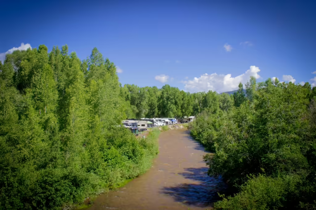
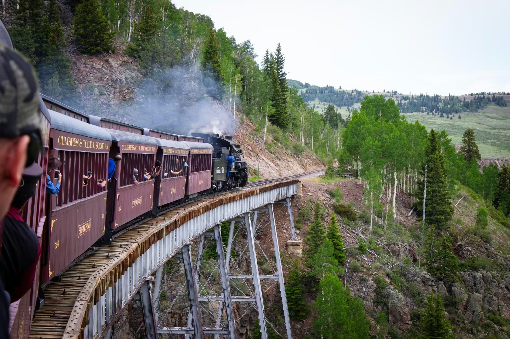
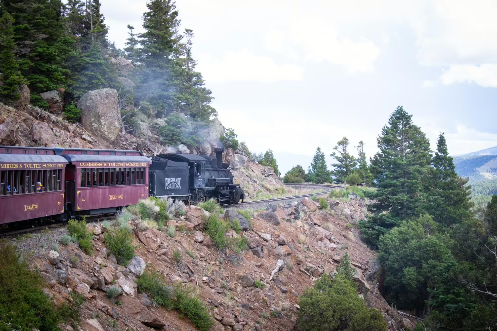
Fortunately for No. 489, the first few miles are fairly tame as we traverse open countryside along the east bank of the Rio Chama. As we emerge from a cut in the terrain between the river and State Highway 17, we come across our first point of interest on the railroad: Lobato Trestle.
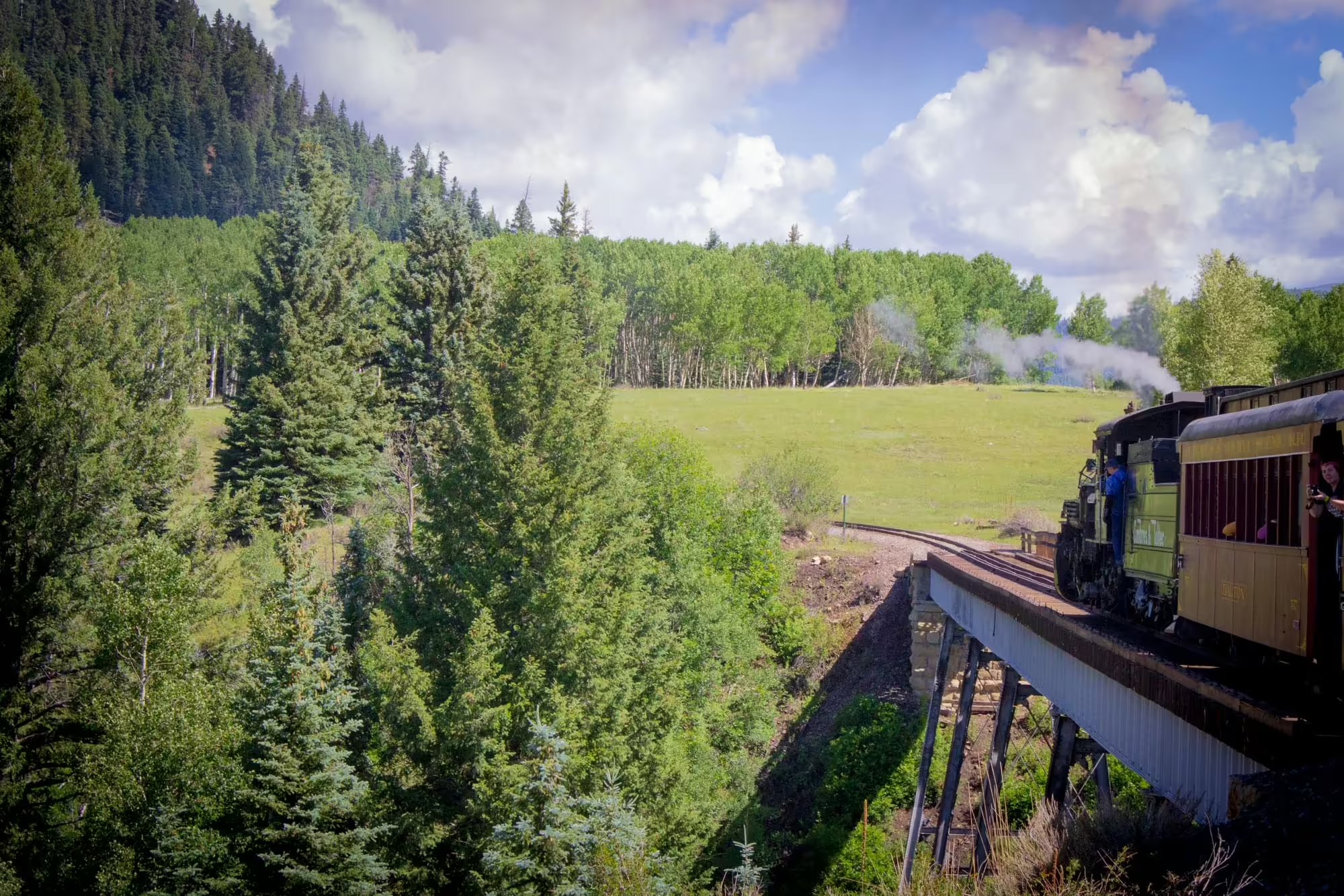
Spanning 340 feet and standing 100 feet above Wolf Creek below, this is one of two steel trestles along the Cumbres and Toltec Scenic Railroad. The trestle, built in 1883, can handle today’s train of one steam engine and eight cars. But for trains with two steam engines (also known as double-heading), the first engine must uncouple from the train and cross the bridge before the rest of the train can cross.
Today we have no problem getting across the structure, and the engineer even slows the train down a bit to give us a chance to snap photos from this vantage point.
After crossing the bridge, we get up from our seats in the coach car and head back to the gondola car we saw earlier. Here, the views become almost immaculate as we get an unobstructed view of the landscape all around us.
We’re also able to easily tell that we are headed uphill. No. 489 begins to show signs of struggling a bit as we climb towards Cumbres Pass. Our forward motion has visibly slowed down, and the usual rhythm of the engine’s smokestack is periodically replaced with faster pulses of air — a telltale sign of wheels slipping against the steel rails on an incline. We can feel the train stumble and lurch forward with each wheel slip.
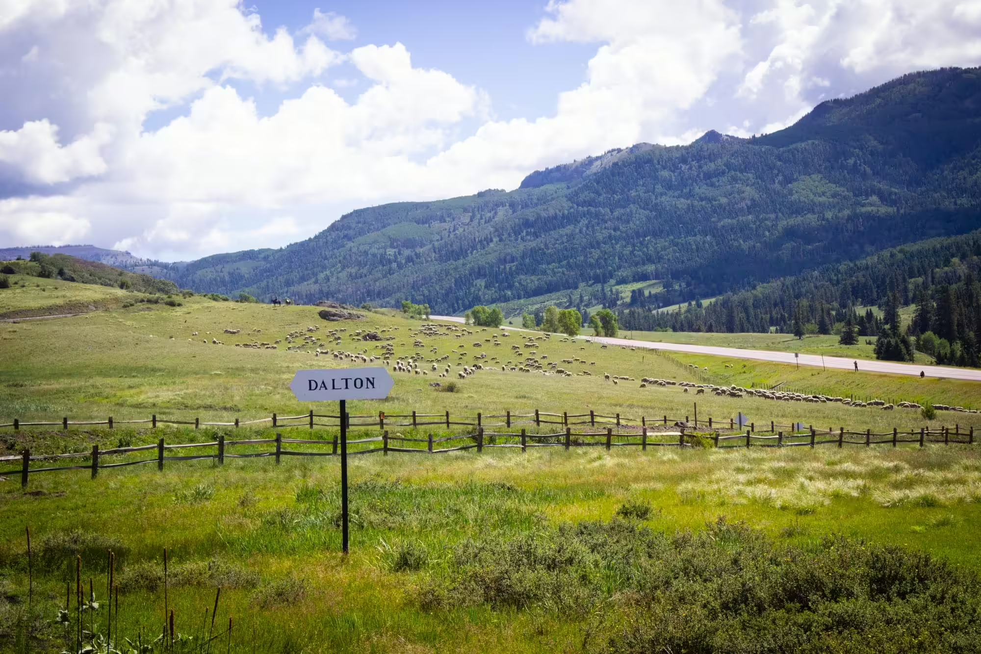
Soon we reach a sign that reads “Dalton” and find herds of sheep and cattle. A lot of the land around the railroad is land owned by the Bureau of Land Management, which will lease the land to ranchers to bring their livestock into the mountains to graze during the summer months. A few sheep wander onto the tracks ahead of the train as we slow down a bit, but fortunately move away after a few blasts from No. 489’s whistle.
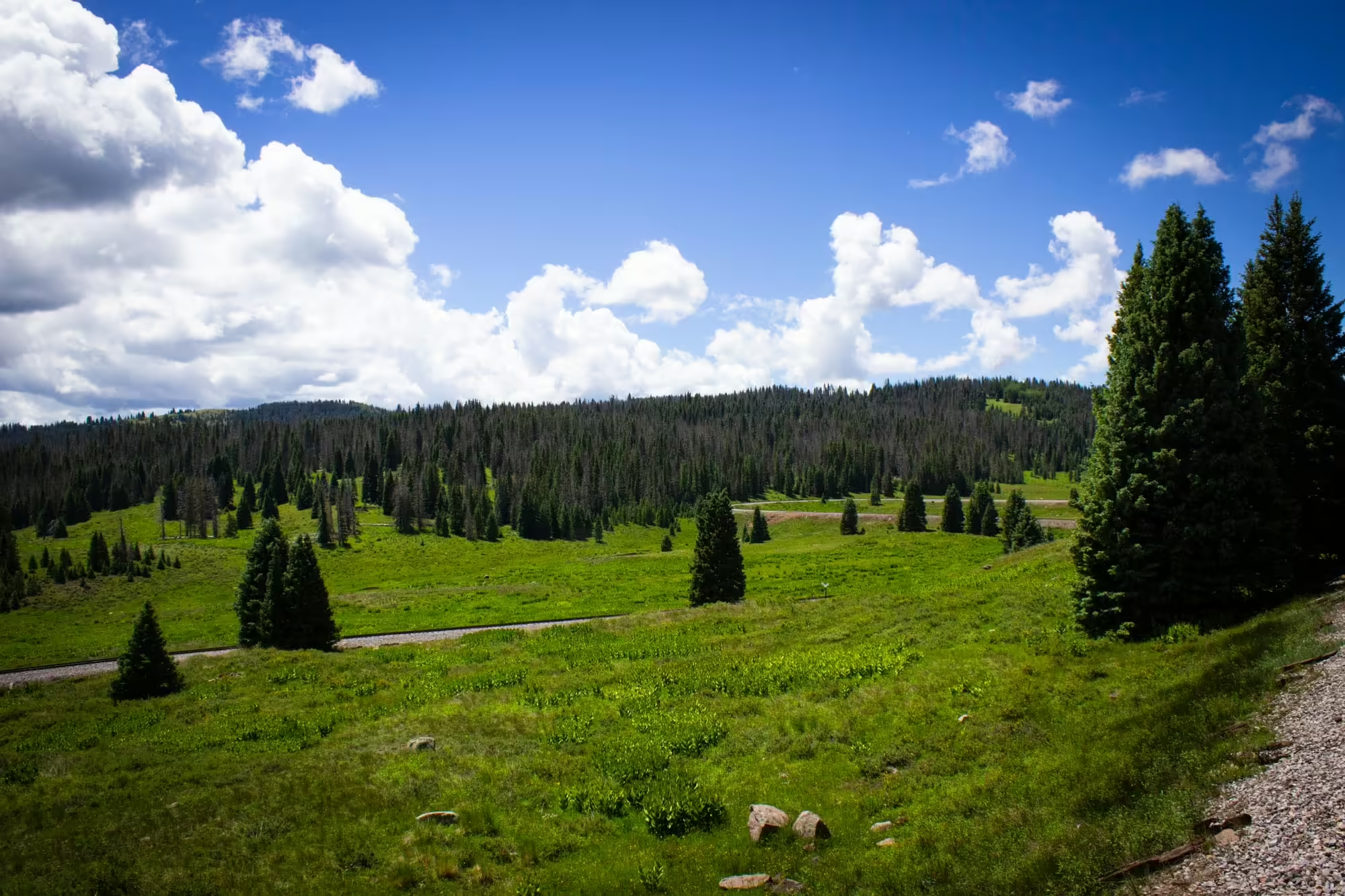
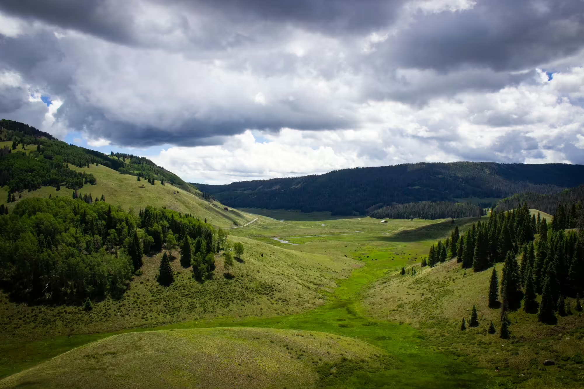
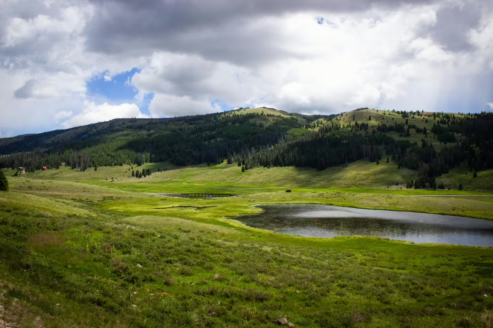
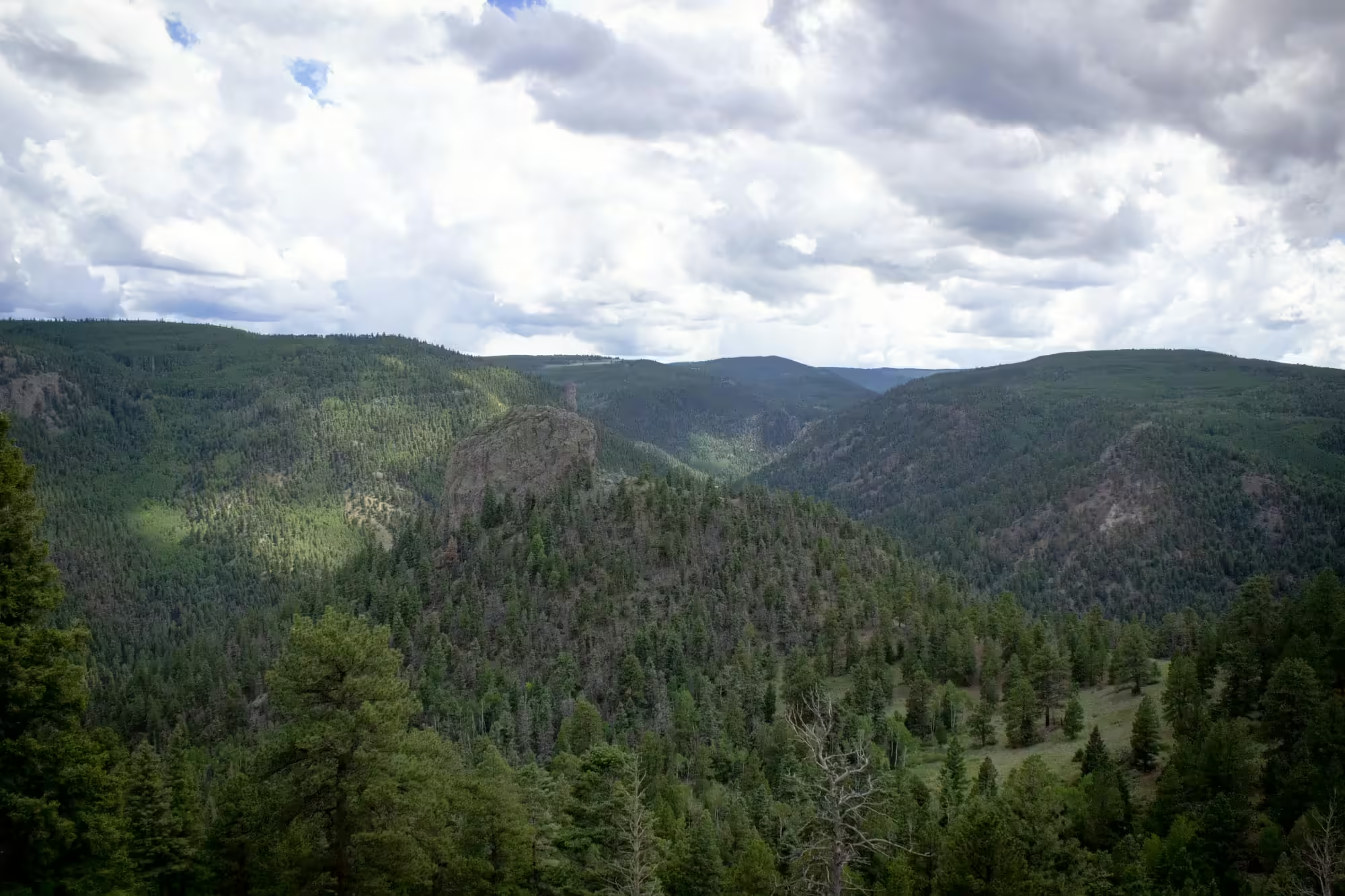
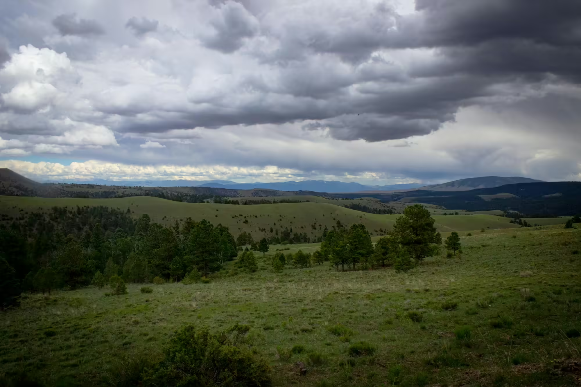
As the train continues to struggle up the grade, we get a great view of the mountain peaks and valleys in this part of the San Juan Mountains. Summer monsoonal rains have given the landscape a nice, deep green color while nice, white puffy clouds help keep the temperatures down.
The train zig zags its way along the north side of the valley; the added turns help to keep the grade from being too much for any train to get to the top of Cumbres Pass.
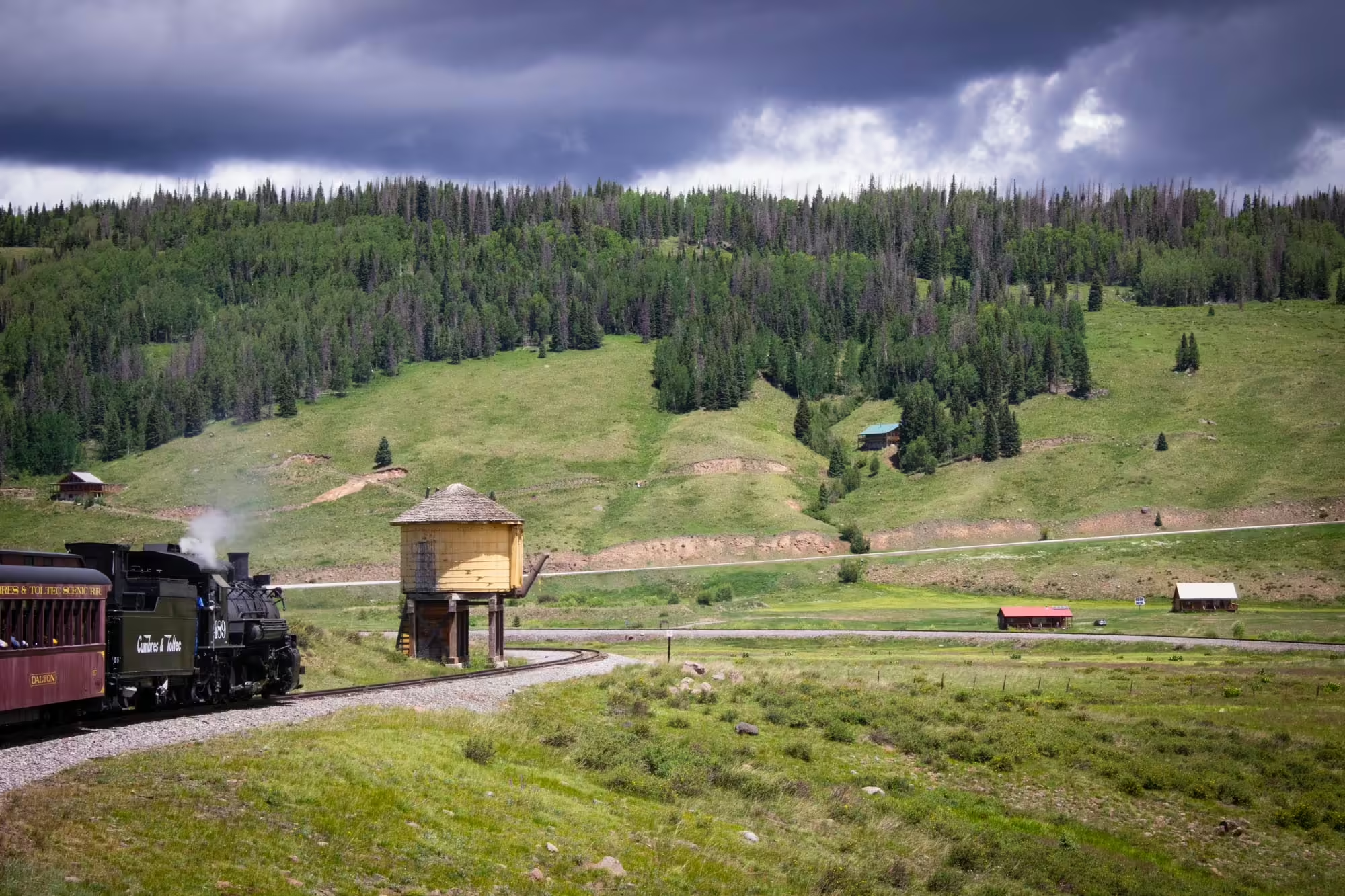
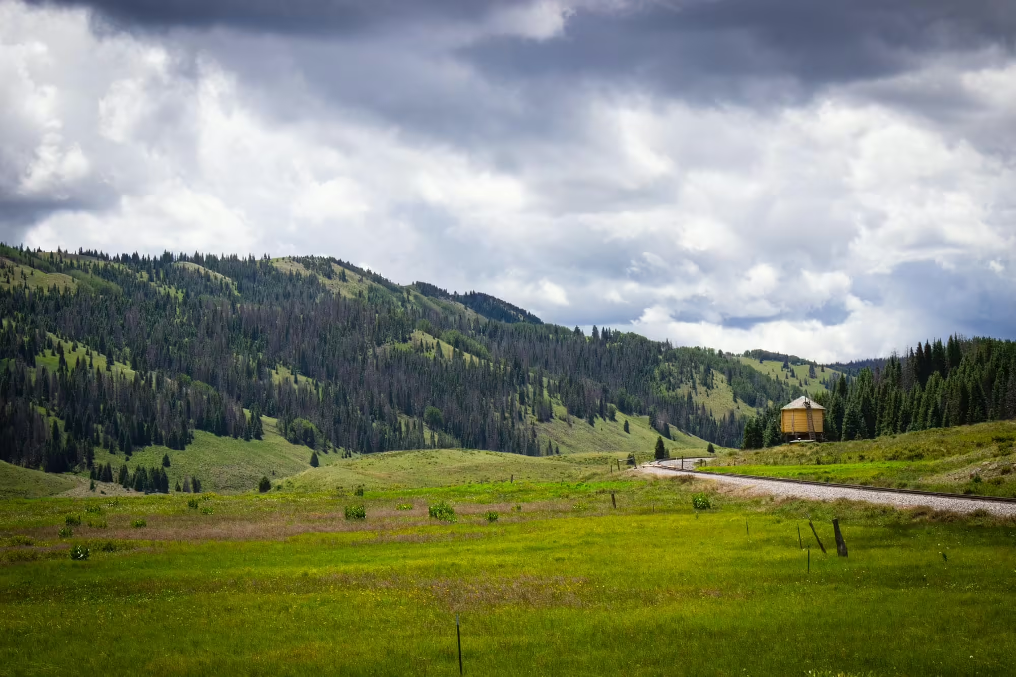
Before long our view is again obscured by trees in a more forested portion of the line. Almost out of nowhere we pass a large, yellow wooden water tank the downhill trains use to fill up the tank for the rest of the journey back to Chama. This is Cresco on the railroad, and lets us know that we’ve made it nine miles in our journey so far.
Less than a mile later we cross into Colorado, the first of 10 times we’ll cross the Colorado-New Mexico border along our journey today.
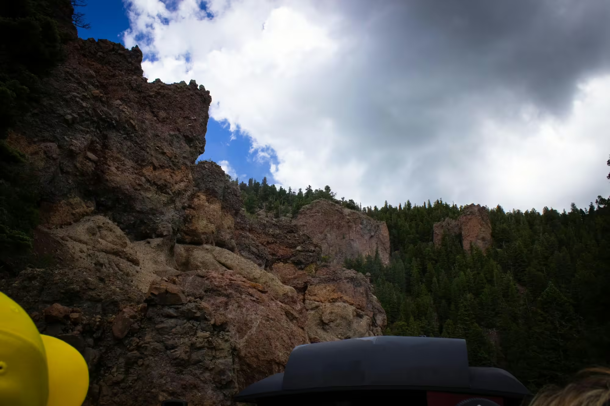
Before long we come to another clearing. Ahead of us we can see a small peak of big rocks and a few trees. We can see two ledges along the side of this peak. One is not too much higher from where we are now. Unfortunately, that’s for State Highway 17. We’re going up to the higher ledge, well over a couple hundred feet higher than where we are right now.
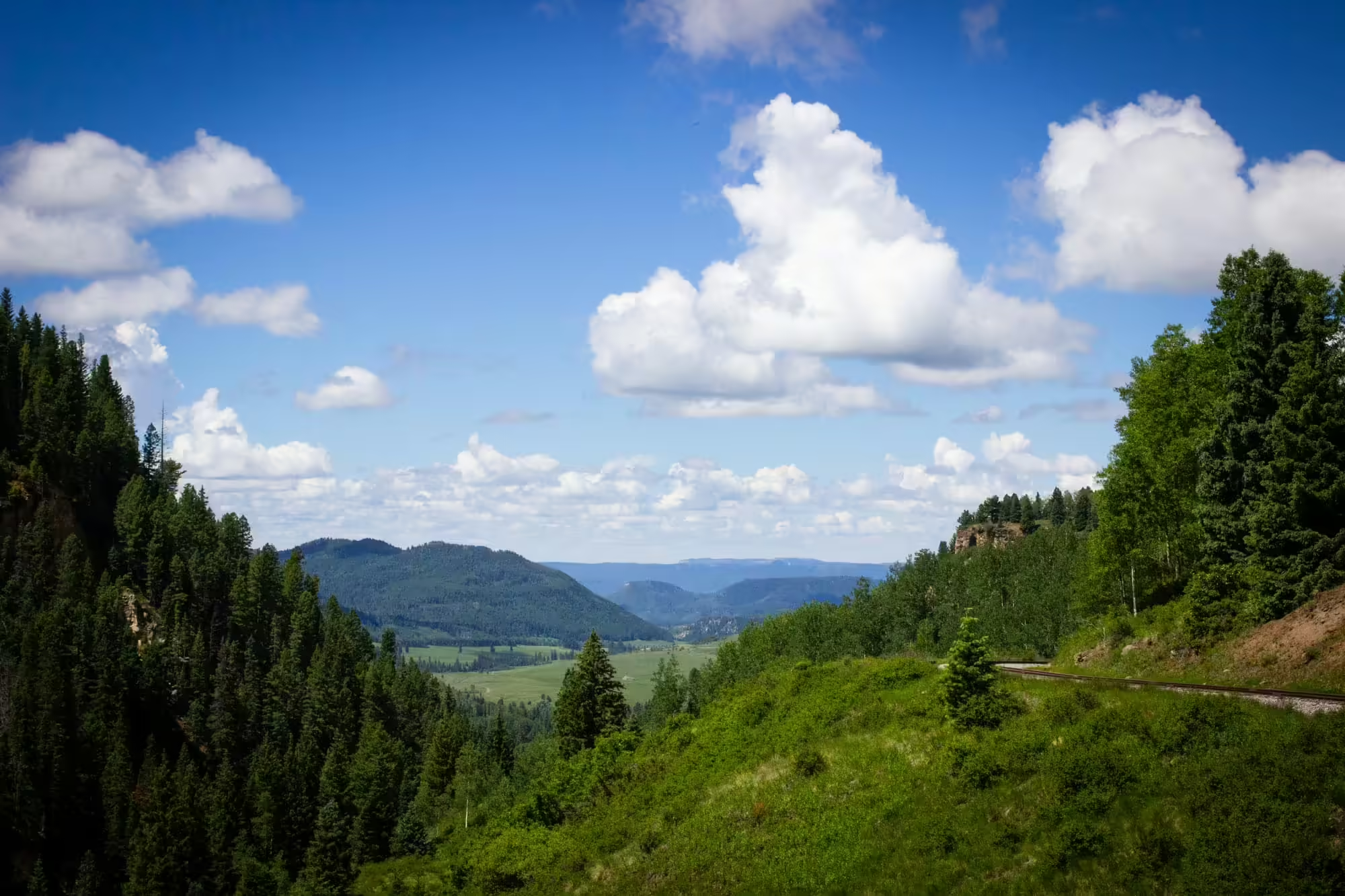
As we cross State Highway 17 once again, we head back into the trees as the tracks continue to climb higher for us to reach the top of Cumbres Pass. After a few more minutes of twists and turns and going around a horseshoe curve, we reach the ledge we saw near the top of Windy Point. Looking back towards Chama, we get a perfect view of where we have just traveled, seeing the valley below and the mountains for as far as the eye can see.
A few more minutes of travel and we finally reach the top of Cumbres Pass. We see a restored yellow station building with two semaphore signals that would have let trains know whether they need to stop for orders before continuing on their journey.
Today our train stops here to get a breather and take on water before we continue on our way.
After settling the Colorado Railroad War with the Atchinson, Topeka and Santa Fe — which saw famous gunfighters Doc Holliday, Dave Rudabaugh and Mysterious Dave fight for the Santa Fe — and relenting on its push for a route between Trinidad, Colorado, and Santa Fe, New Mexico, the Denver and Rio Grande Western began searching for other profitable routes to grow the railroad.
The list of new lines included a narrow gauge line to the mines around Leadville, Colorado, another route to Santa Fe west of Raton Pass, and the line from Antonito west to Durango through the San Juan Mountains, which would become the San Juan Extension. The goal was to tap into those new mines in the Silverton area as moving train loads of silver and gold would be more efficient than trying to truck it out over the primitive roads built on the side of the mountains.
The D&RGW built the over 200 miles of track necessary to get from Antonito to south of Animas City via Cumbres Pass and Chama in a little over a year. The railroad decided to build the line as a narrow gauge line to help save costs as they wouldn’t need to level as much of the grade compared to a standard gauge line.
At their endpoint, the D&RGW built its depot, roundhouse, engine house and other facilities, and over time the population of Animas City moved to this new area, creating the town of Durango.
Soon after finishing the initial line into the San Juan Mountains, the railroad built the remaining 45 miles of track up the Animas River to Silverton in nine months, opening up the mines to the railroad and outside world in 1882.
With two blasts of the whistle from No. 489, our journey continues onward. Looking to our left we see a wye track. Here, helper engines that got eastbound trains up to Cumbres Pass would uncouple from the train, use the wye to turn around and head back down to Chama and get ready to help the next eastbound up the pass.
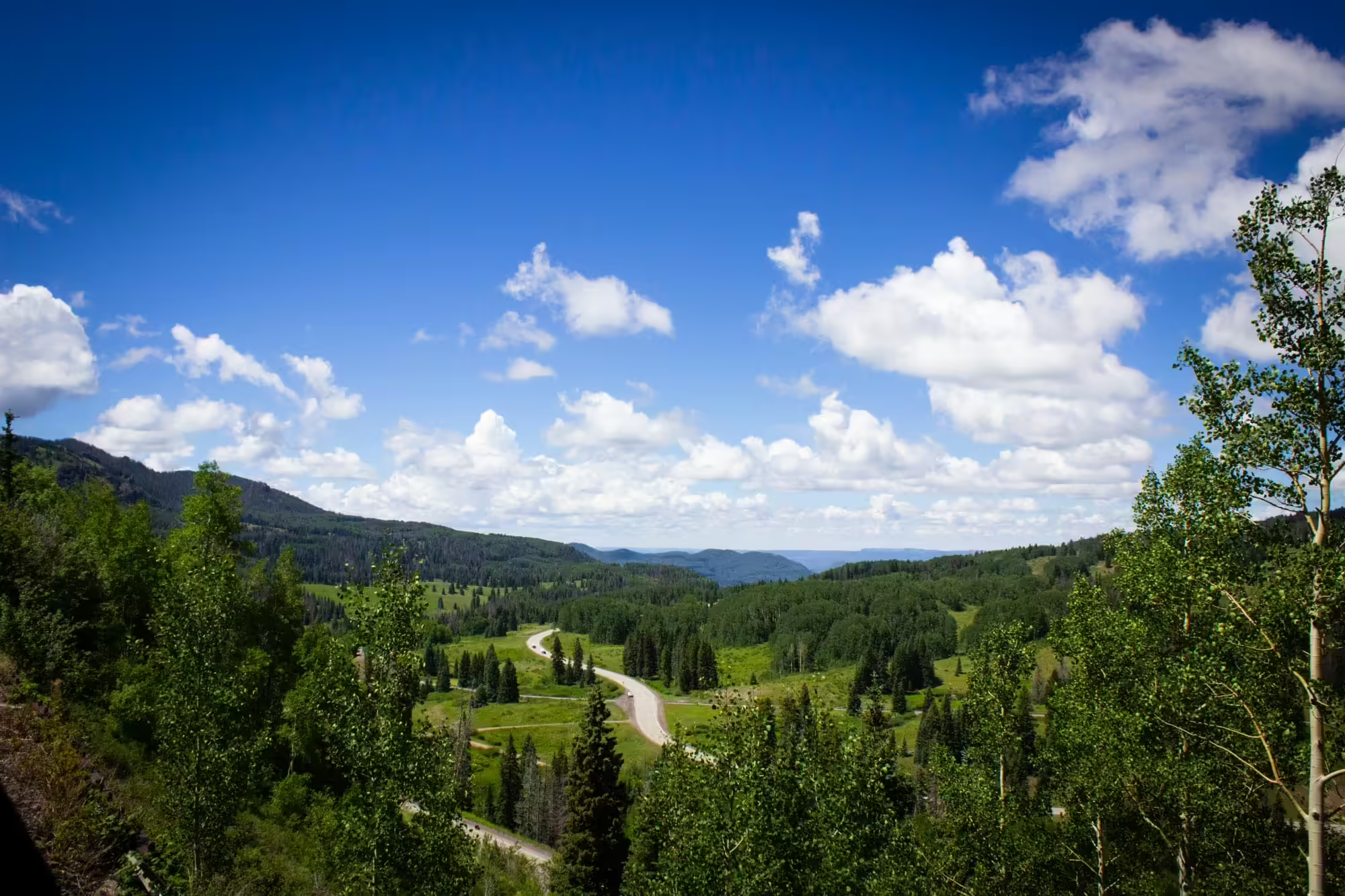
Today, we continue onward, crossing State Highway 17 for the final time and heading back into the trees. And for the first time today, we’re actually descending down into a valley.
After a few minutes of travel, we come to a clearing and on the left side of the train can see the next section of track right below us.
This is Tanglefoot Curve. Here a crew member that needed to get from the rear of the train to the engine could disembark, stumble their way up or down the small embankment and board the engine.
Our journey is much more relaxed now as we are in a small valley with fairly level tracks. No. 489 is finally able to pick up the pace a bit, although the fastest a train can go on this line is 15 miles per hour, the same as when the line was first built over 100 years ago.
Looking behind us, we also finally spot a small motorized speeder following about a quarter mile behind us. The Cumbres and Toltec has one following every train looking for small fires that might have been started by the train. While most of the C&TS engines (including No. 489) have been converted to burning oil which lessens the chance of starting a fire, a 55,000 acre wildfire started by the C&TS’ sister railroad, the Durago and Silverton Narrow Gauge Railroad, has them taking no chances.
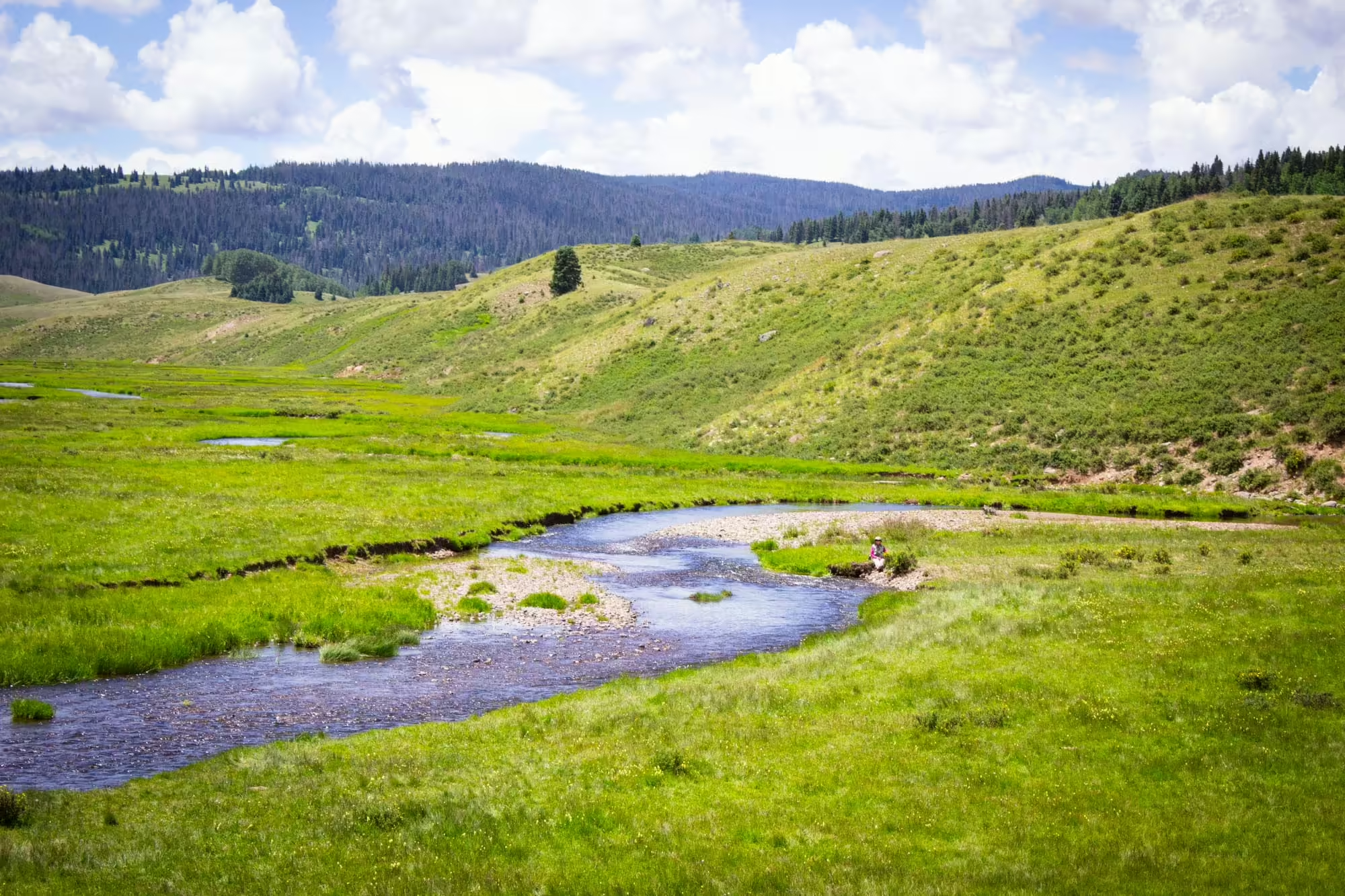
As we turn north into another valley, we once again pass another large yellow water tank. This is Los Pinos on the railroad, named for the Rio de Los Pinos on the right side of the train. After making another horseshoe curve turn, we see a couple of fishermen fly fishing in the shallow creek. It’s the perfect day for fishing — it’s sunny and only about 80 degrees on this summer day. But we continue on.
Soon we once again find ourselves on the side of a cliff. The creek which had been level with us a few minutes ago is now several hundred feet below us.
Without warning, several military aircraft fly overhead. Apparently the Air Force likes to use the railroad as simulated target practice. I’m not entirely sure how to take that information, but the view is too beautiful to dwell on that fact for long.
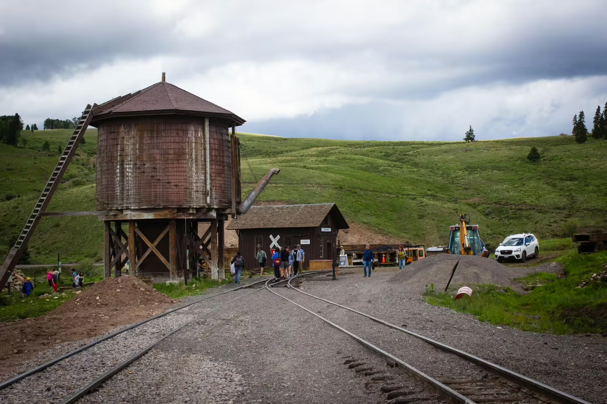
After crossing the second of two steel trestles (this time over Cascade Creek), we’re told to head back to our seats for our arrival into Osier. Here the train will stop and we’ll get off to have a barbecue lunch in a refurbished station building along with passengers from the westbound train.

A few minutes later we arrive in Osier, though there’s honestly not much to see. We pass a small railroad office building and another water tank before coming to a stop and disembarking the train for lunch.
Predictably, traffic boomed on the new San Juan Extension almost immediately.
During the height of the Silverton mines, over 40 mines were in operation, bringing goods and people in and silver, gold and other minerals out on the railroad.
It seemed the Denver and Rio Grande Western had struck metaphorical gold with this line, and everything seemed great for the railroad.
But the first sign of trouble came with the Silver Panic of 1893.
After the Sherman Silver Purchase Act in 1890, which required the government to purchase 4.5 million ounces of silver every month to mint coins to stem a cycle of depression, deflation and inflation, silver prices began to grow and mining of the metal grew at an astronomic pace.
While the act temporarily helped the farmers and miners who lobbied for its passage, the flood of new silver in the market then caused prices to drop, leading to a repeal of the Sherman Silver Purchase Act in 1893.
Silver prices began to slowly rebound, and substantial gold was found in the mines as well plus lead and zinc, helping the line stay profitable.
But it wouldn’t last. In 1910, most of the mines began to close around Silverton, drying up a reliable source of revenue for the line and casting doubts on its future.
Fortunately for the San Juan Extension, agriculture and timber began to increase on the line to pick up the slack.
In 1905, the D&RGW built a 47.1 mile extension from Durango to Farmington, New Mexico, aptly called the Farmington branch, to connect with the farms and ranches in the Farmington area in northwest New Mexico.
In 1900, the railroad opened the Pagosa Springs Branch, which ran 30.7 miles from Gato, Colorado, up to Pagosa Springs, Colorado, shipping out train loads of timber daily.
Maybe there was still hope for this line after all.
After finishing a delicious lunch and walking around the area, we once again board our train to Antonito and start our journey eastward.
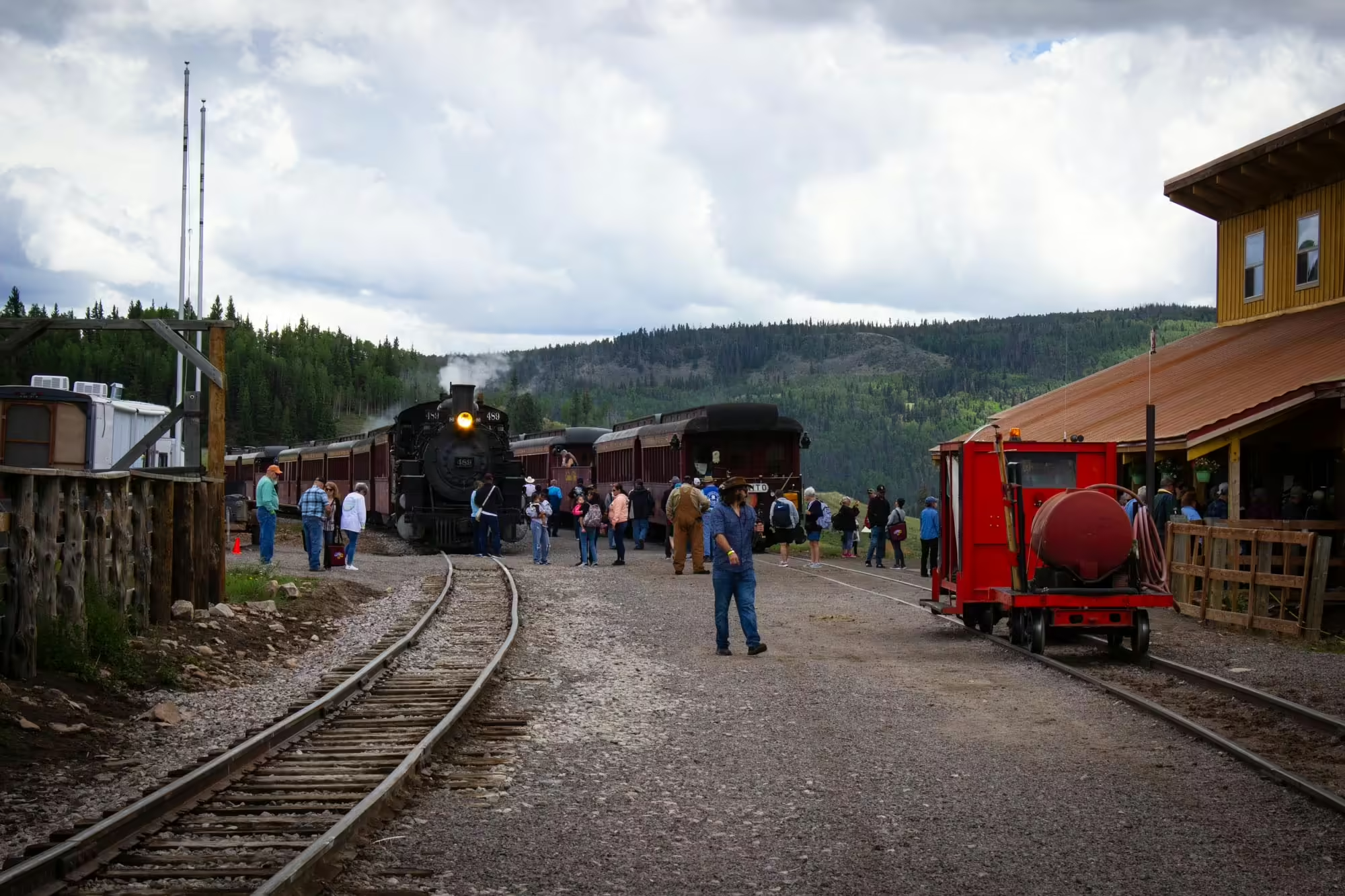
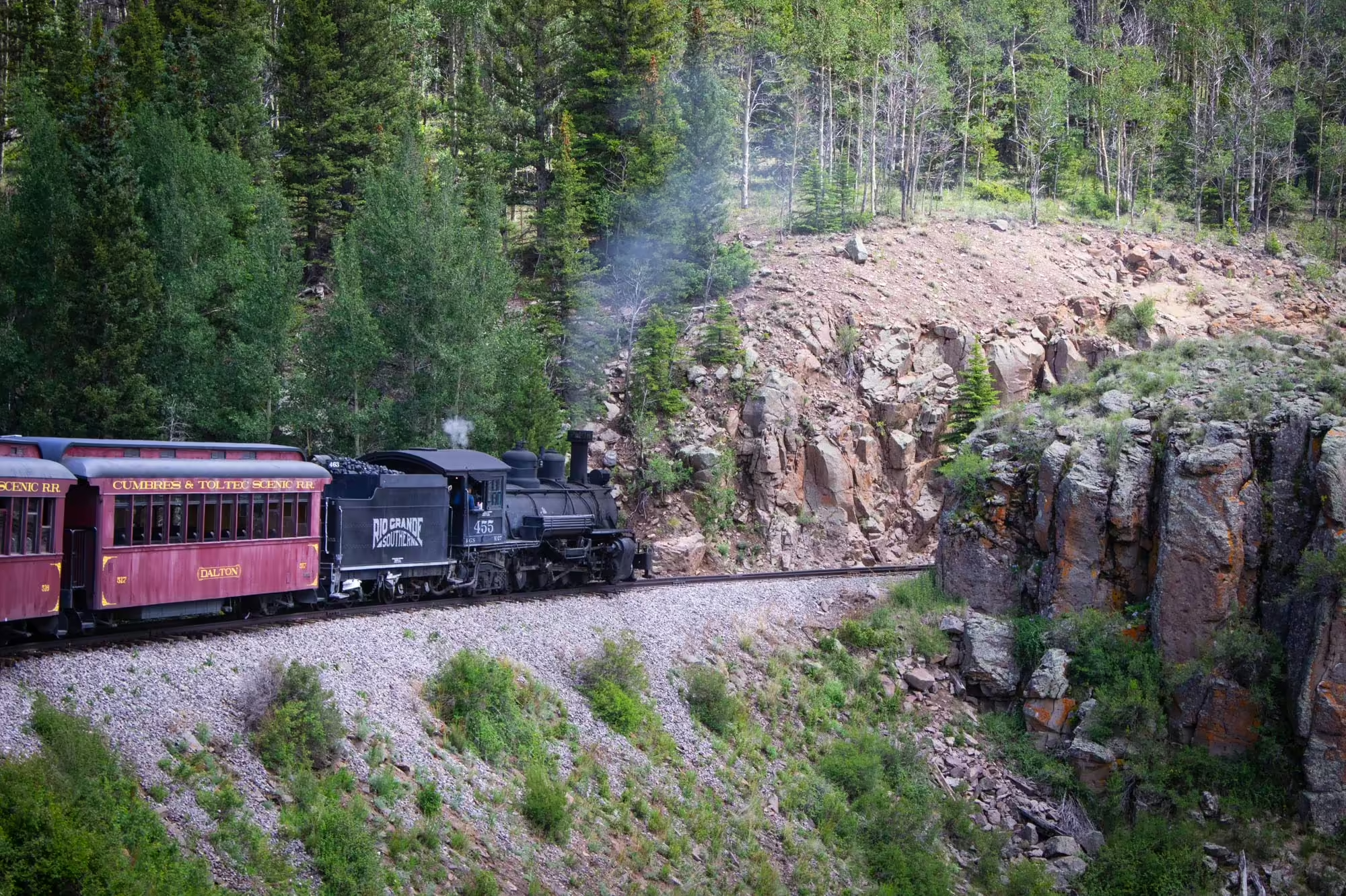
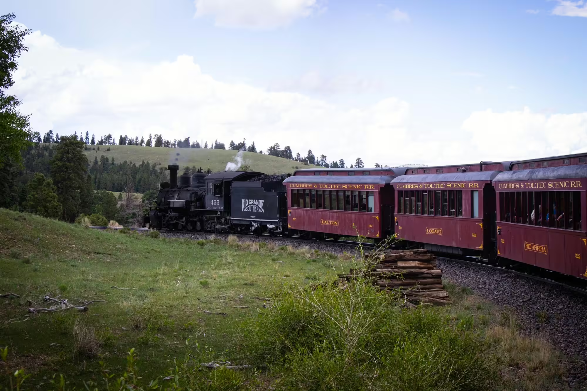
While we were enjoying lunch, the crew swapped our engine, moving No. 489 to the westbound train back to Chama while we picked up No. 463, a 2-8-2 K-27 (an earlier predecessor to No. 489) that today is sporting No. 455 and the Rio Grande Southern logo on the tender. The Rio Grande Southern ran from Durango to the northwest through Lizard Head pass before turning east and passing Telluride and connecting with the Denver and Rio Grande Western in Ridgeway.
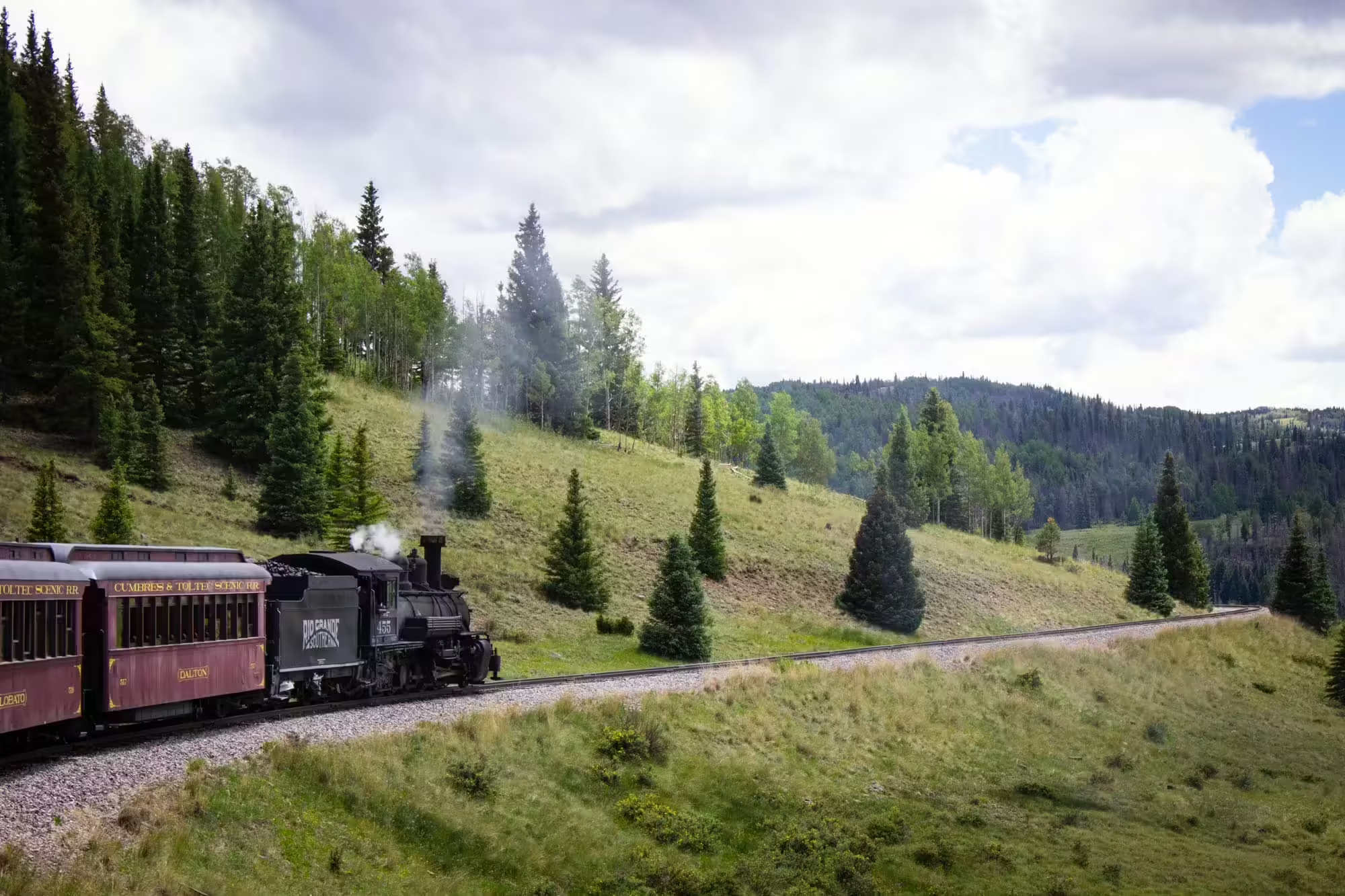
No. 489 is the stronger of the two locomotives in regular service this summer and is needed to pull the train up and over Cumbres Pass. But No. 463 will be perfectly fine to get us the rest of the way out of the San Juan Mountains.
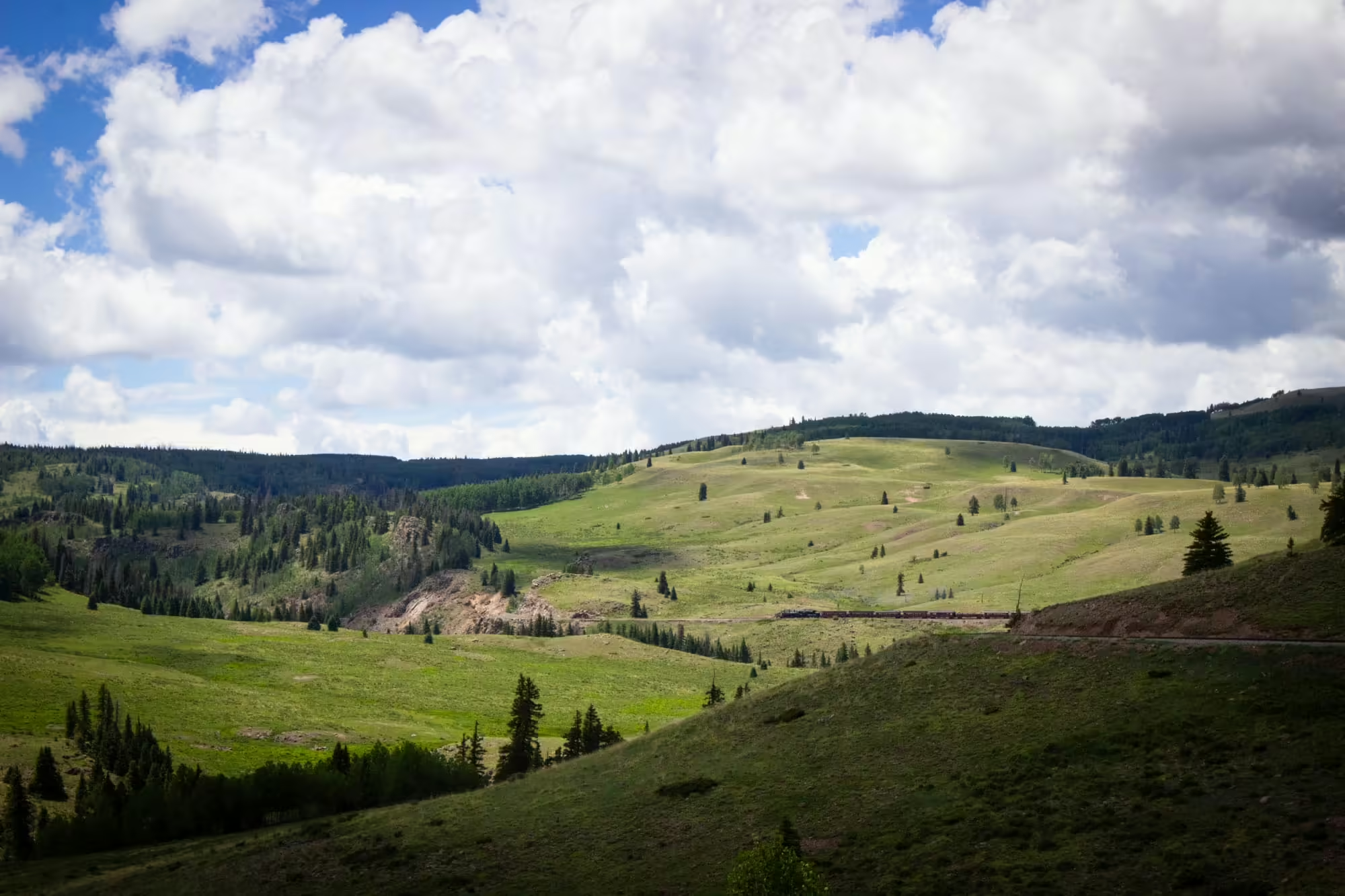
A mile out from the stop in Osier we look back and can see No. 483 pulling the westbound train in the distance. The small speck against a wall of green gives a great perspective of just how big these mountains are.
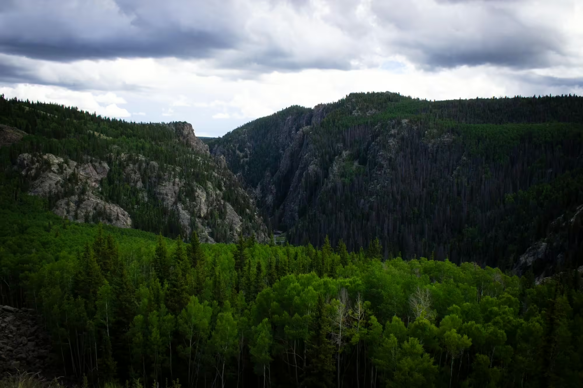
As we continue on, we notice that the scenery is getting much rockier compared to what we’ve experienced today. In the distance we can see Toltec Gorge. This one of the trickier parts of the railroad to build
But today it gives us some of the best views we’ll see all day in the San Juans.
As one of the higher parts of the line, we’re able to get a good view of the mountains and valleys all around us. Across the gorge, we see the other rock face and wonder how some of the trees are even able to grow along the cliffs. Below us is that same Rio de Los Pinos now over 500 feet below us.
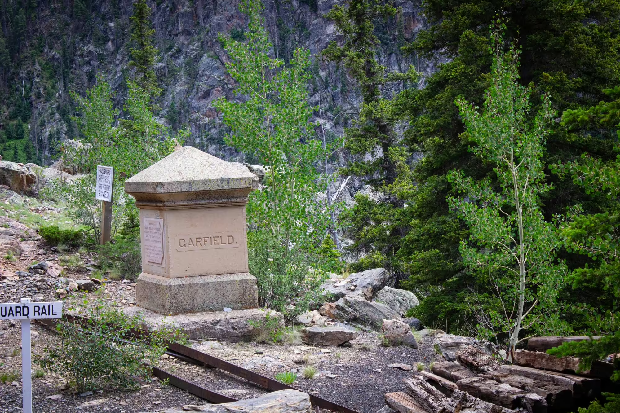
After several minutes of traveling along the top of the gorge, we come across a monument the workers of the original line built for former President James Garfield after his assassination in 1881.
We get one final glimpse of the creek way below us and head into a tunnel.
Unfortunately for the Denver and Rio Grande Western mining dropped considerably in the 1930s along the Silverton Branch and the San Juan Extension.
The start of World War II brought relief to the line as the need to mine more material for the war effort grew with the United States’ entrance into the war.
But traffic died down once again after the war as more mines in the area closed and the new paved highways in the area saw more and more goods moved by trucks rather than trains.
In 1951, passenger traffic ended when the daily Alamosa to Durango train was eliminated. In 1952, the Rio Grande Southern Railroad, which connected with the D&RGW in Durango and Ridgeway, Colorado, closed for good.
The writing seemed to be on the wall that the San Juan Extension was not long for this world.
The line’s death, however, was put on hold in the mid 1950s thanks to increased tourism on the passenger train between Durango and Silverton and an oil and gas boom in Farmington, which brought trains carrying pipes and other drilling supplies over the San Juan Mountains to the New Mexico town.
Unfortunately, this traffic dried up in the 60s as the oil and gas wells were completed. The line averaged just over one train a month in 1966. And in 1967, the D&RGW filed for abandonment of the line.
It was the end of the line for the San Juan Extension and narrow gauge railroading in Colorado.
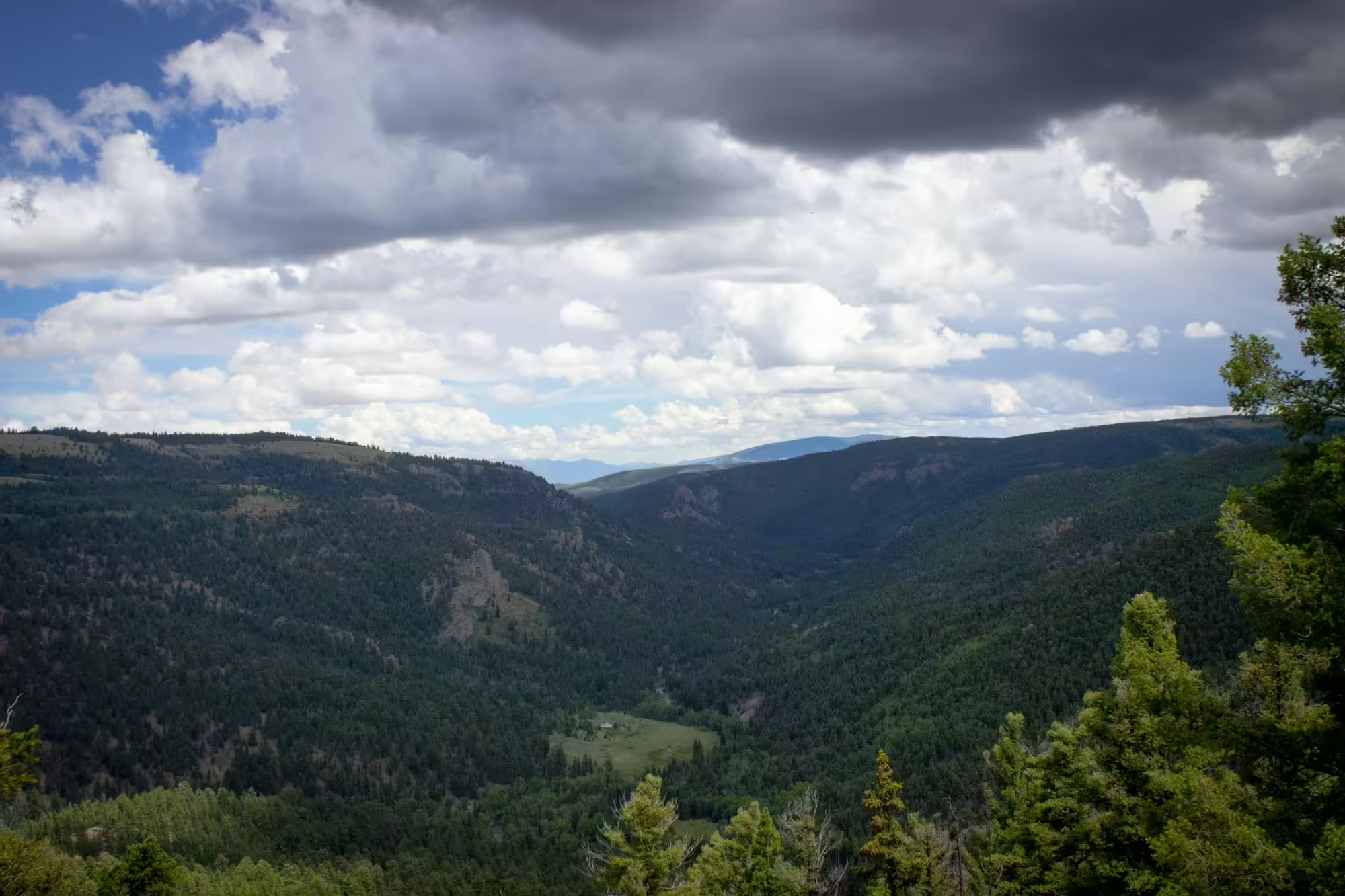
We emerge from the tunnel and, while we’re no longer in the gorge, the rocky terrain remains with us. We dart in and out of various cuts in the terrain as we wind our way through the eastern edge of the San Juan Mountains. While this part of the journey isn’t challenging for our train, the engineering and work to build this part of the line must have been quite the challenge.
We enter the second of two tunnels on our journey and pass through Phantom Curve, named for the rock formations that would cast shadows from a train’s headlight at night that resembled an oncoming train.
Overhead we notice the clouds gathering and turning a darker shade of gray. Rain is probably on the way, but for now we enjoy the cooler temperatures out in the gondola car.
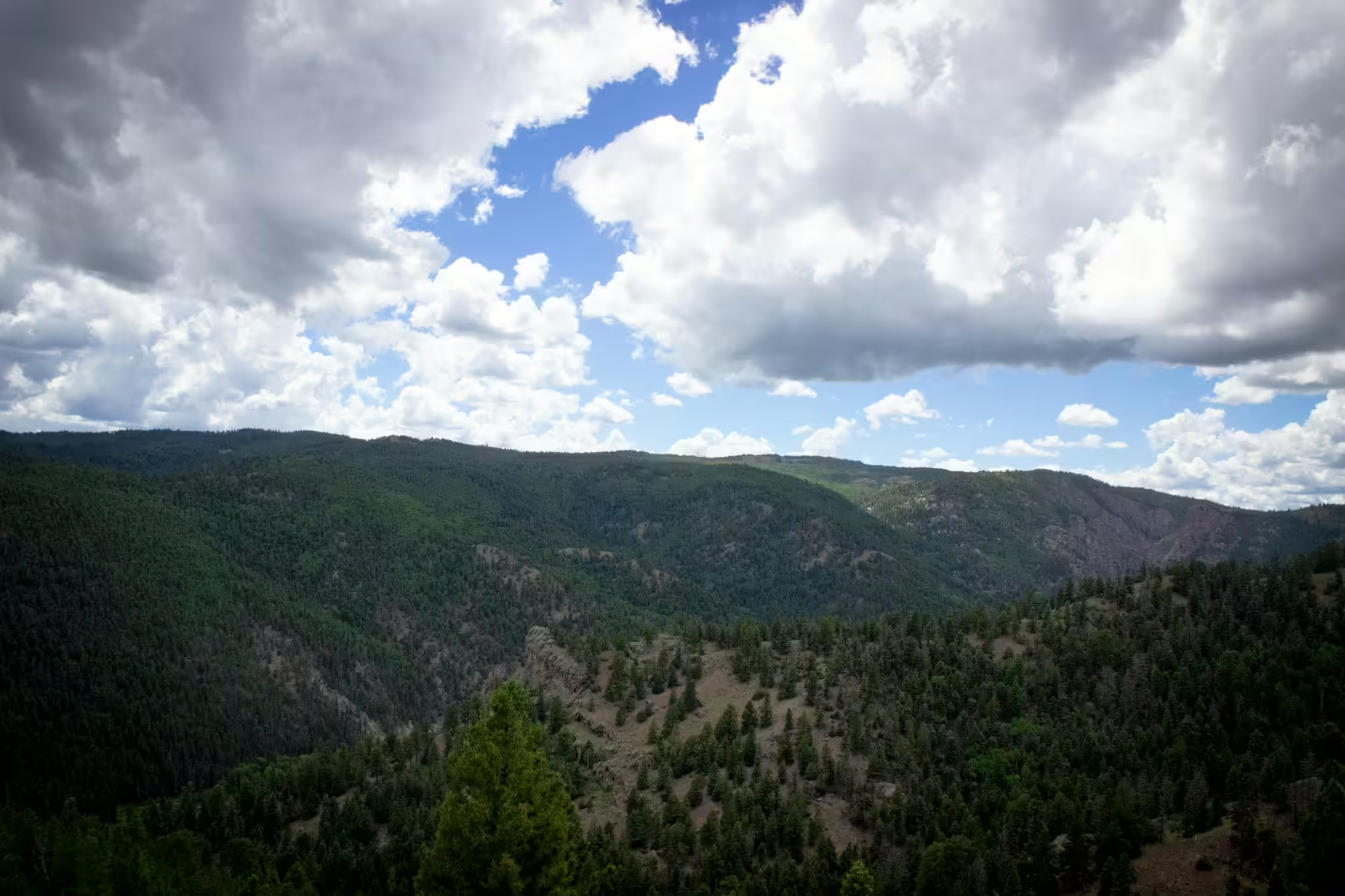
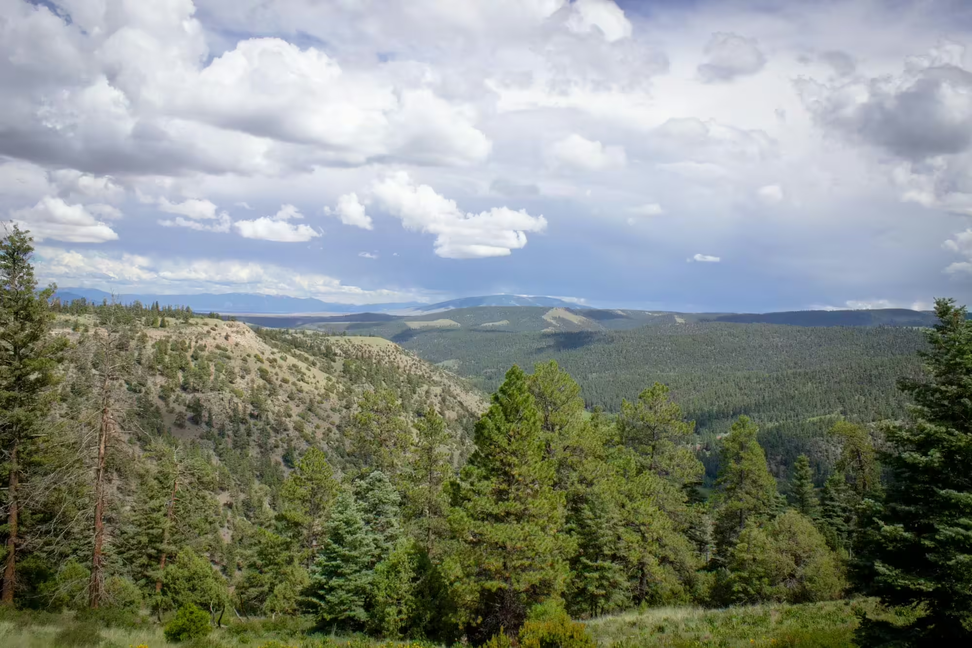
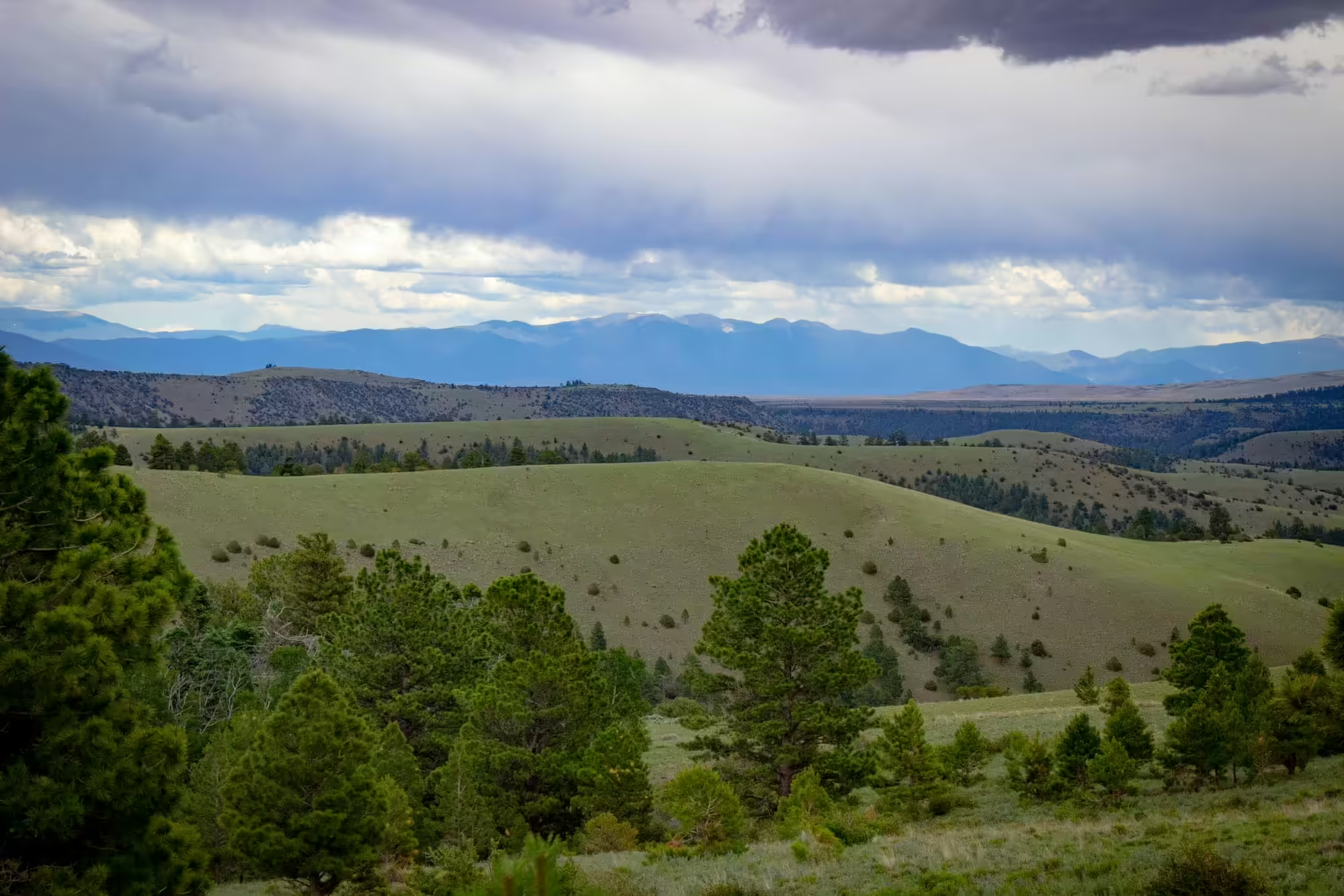
As we skirt around the top of the mountains, we are treated to spectacular view after spectacular view of this part of the San Juans. With State Highway 17 completely out of view, the railroad is the only way to get these pristine views, and we’re enjoying every second of it.
Before long we start to get a glimpse of the Sangre de Cristo Mountains, which lie well over 70 miles to the easy past the San Luis Valley. That’s the kind of amazing view we have here on our journey today.
Soon after we come to a stop at Sublette to take on water for the final time.
Here we see several white buildings on the right side of the tracks. The biggest is a section house. This is where maintenance of way crews would stay on the railroad and spend the day maintaining the line and fixing various issues with the track when they would arise.
Today, this group of buildings is the best maintained set of buildings that passengers don’t step into. And we can see why, as several members of the Friends of the Cumbres and Toltec Scenic Railroad stop their restoration work to greet the train. A number of members of the group spend weeks at a time in the summer months working on restoration projects or riding the train and sharing the history of the line with passengers.
After the tender is topped off with water, the engineer gives two blasts from No. 463’s whistle and we lurch forward.
Next stop: Antonito.
As it turns out, abandonment wasn’t quite the end of the line for the San Juan Extension. Or at least parts of the extension.
The section between Durango and Silverton, which had always been a popular route for tourists visiting this part of Colorado, continued to operate as a tourist route by the Denver and Rio Grande Western before being sold to Charles Bradshaw Jr. in 1981 who formed the Durango & Silverton Narrow Gauge Railroad to operate the line as it does today.
The section of the San Juan Extension between Chama and Antonito rivaled the views of the Silverton branch and was a focus of preservation efforts to keep the line active. A group of citizens worked with the states of Colorado and New Mexico to purchase that section of the line in 1971 and formed the Cumbres and Toltec Scenic Railroad, which continues in operation today.
In 1973 the C&TS was listed on the National Register of Historical Places, and in 2012 was named a National Historical Landmark.
Today the C&TS operates two trains daily between May and October with one starting in Chama and the other starting in Antonito. Passengers can either ride all the way across and be bussed back at the end of the day or switch trains at Osier to return to where they started the day.
A group called the Friends of the Cumbres and Toltec Scenic Railroad also helps to build and restore buildings along the line and non-operational rolling stock as well as ride the train the tell the history of the line and the area to passengers.
While it might no longer haul the freight that made the line what it was, it has found a great new life telling the history of life in the San Juan Mountains.
We’re now approaching the Big Horn Wye as we creep closer and closer to Antonito and the end of our journey.
The terrain here is vastly different from where we started. Gone are the long, steep climbs up the side of mountains and forest trees. Instead, they’ve been replaced with flat land and sagebrush of the San Luis Valley.
As we pass Big Horn Wye, rain drops begin to fall from the now dark gray clouds above. First there’s one drop. Then another. And then more and more as they become bigger and bigger.
With the most scenic portion of the ride behind us, now is a great time to get back to our seat in the coach car and out of the rain. And it’s not a moment too soon. As we sit down in our seats, the heavens open, sending a deluge of water onto the valley.
As water drips in from small cracks in the roof, the engineer lets the engine stretch its legs and opens the throttle. No longer restricted by the steep climbs and drops and tight turns, No. 489 can really show what it can do in a sprint to the end of the line.
After about 45 minutes of speeding along the valley as cloud to ground lightning strikes around us, we finally arrived in Antonito. This is the end of our wonderful journey through the San Juan mountains.
But passengers and freight in the heyday of the Denver and Rio Grande Western would have continued on, first north to Alamosa, then west to Walsenburg and finally north to Pueblo and points beyond.
As for us, the train slows to a stop at the station. We get out and dash through the rain to a waiting charter bus to take us back to where we started in Chama, and finishing an incredible day on an amazing mountain railroad.
A big thanks to drgw.net for a great website that documents the entire history of the Denver and Rio Grande Western and was the source for all of the railroad information in this story. If you ever want to fall down the rabbit hole of information about the D&RGW, that is a great place to go!
Get the Entire Gallery
The Cumbres and Toltec Scenic Railroad gives riders a spectacular view of the San Juan Mountains, as you just saw. Now you can take home those same awesome views for your website, your home, your business or wherever else you want to show them. Just check out the photo gallery below and select the photos you want or get the entire gallery for just one easy price!